



F-Roads · Iceland
Iceland F-Roads
51 mapped · 4WD required · Open ~June–September · 2WD illegal
 gesturpa · Wikimedia Commons · CC BY-SA 2.5
 Borvan53 · Wikimedia Commons · CC BY-SA 3.0
 Moyan Brenn from Italy · Wikimedia Commons · CC BY 2.0
F-roads are Iceland's unpaved highland routes — 51 mapped here, all legally requiring 4WD. 2WD cars are banned outright and rental insurance never covers river-crossing damage. Most open mid-June to early July and close by September or October. Check our live F-road map the morning you drive — conditions change fast, and a road open yesterday can be closed today.
How many F-roads are open in Iceland right now?
2 of 40 F-roads tracked by umferdin.is are open right now and 7 are closed (31 not currently reporting). Per-road status is on our live F-road map — always check conditions on the day you drive.
Data verified 16 October 2026, 06:33 · source: umferdin.is (Vegagerðin, the Icelandic Road Administration) · refreshes every 10 minutes
Planning around weather or roads? Live conditions across Iceland →
Top F-roads
Iceland’s best-documented highland routes, with real access info. Distances on the cards are straight-line from Reykjavík.


 Directions
 Save
Save Share
ShareCars & campers
 KEF airport pickup 24/74.8
 Transmission
 Fuel
Fuel Seats
Seats Drive
Drive

 Sleeps
Tours near Iceland's F-roads
 Small groups
 Duration
 Highlights
 Type
Type

When & how to drive Iceland's F-roads
F-roads only open once meltwater drops, usually mid-June to early July, and most close by September — a few of the toughest (Fjallabak, Askja) sometimes hold into early October if the weather cooperates. Every F-road legally requires 4WD; driving one in a 2WD car is illegal and voids your rental insurance outright. River crossings are never covered by any rental policy, even full-coverage plans — cross only where locals or rangers confirm it's safe, and never after heavy rain. Check road.is the morning you drive: conditions change fast, and a route open yesterday can be closed today. Beginners should start with an easier route like F35 (Kjalvegur) before attempting river-crossing roads like F210 or F249.
The F-roads of Iceland, compared
All 51 F-roads, ranked — our best-documented picks first, each with the minimum vehicle it takes. Every one requires 4WD by law, but that is where the answers stop being the same: some suit a small crossover, a few are super-jeep only. Tap any name for the full guide, including opening dates — how much 4x4 you need breaks the 51 down by class.
| F-road | Region | Difficulty | Min. vehicle | Known for | |
|---|---|---|---|---|---|
| F26 Sprengisandsleið | Highlands | hard | large 4x4 | The longest highland road |
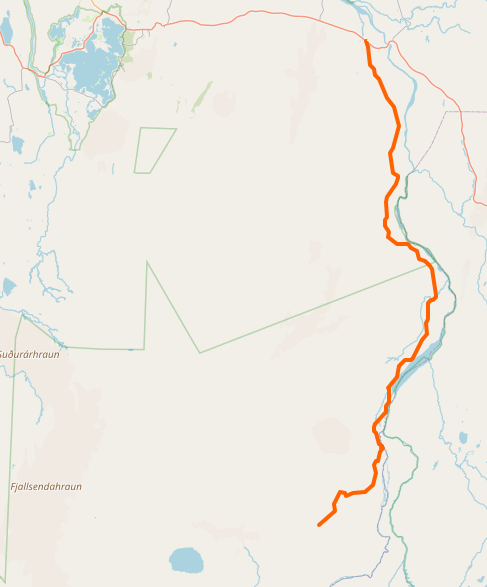 | F88 Öskjuleið | Highlands | medium-hard | medium 4x4 | Shortcut to Askja caldera |
| F208 Fjallabaksleið nyrðri | South Coast | varies | any 4x4 north / medium 4x4 south | The road to Landmannalaugar |
| F210 Fjallabaksleið syðri | South Coast | hard | large 4x4 | Fjallabaksleið syðri |
 | F224 Landmannalaugavegur | South Coast | medium | medium 4x4 | Final stretch to Landmannalaugar |
 | F225 Landmannaleið | South Coast | medium | medium 4x4 | Western shortcut to Landmannalaugar |
 | F228 Veiðivatnaleið | South Coast | medium | medium 4x4 | Road to fishing lakes |
 | F235 Langisjór | South Coast | medium | medium 4x4 | Road to Iceland's most beautiful lake |
 | F249 Þórsmerkurvegur | South Coast | extreme | super jeep only | The road to Þórsmörk valley |
 | F333 Haukadalsvegur | South Coast | easy | any 4x4 | Starts at Geysir |
 | F335 Hagavatnsvegur | South Coast | medium | medium 4x4 | Road to a glacier lake with a hidden waterfall |
 | F338 Skjaldbreiðarvegur | South Coast | medium | medium 4x4 | Power line road across a shield volcano |
 | F349 Kerlingarfjöll old | Highlands | hard | large 4x4 | The long, lonely way to Kerlingarfjöll |
 | F570 Jökulshálsvegur | West Iceland | easy | any 4x4 | Mountain road near Snæfellsjökull glacier |
 | F578 Arnarvatnsvegur | Westfjords | hard | large 4x4 | Road to 100+ lakes |
 | F586 Haukadalsskarðsvegur | Highlands | easy | any 4x4 | Mountain pass to Viking history |
 | F839 Leirdalsheiðarvegur | North Iceland | medium | medium 4x4 | Valley drive ending at the sea |
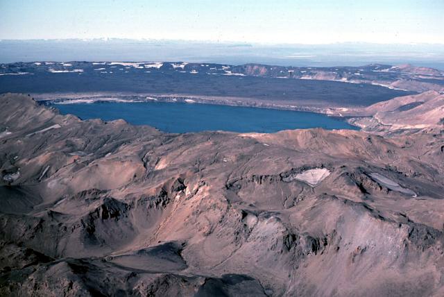 | F843 Dyngjufjöll | North Iceland | hard | large 4x4 | The forgotten road to Askja |
 | F899 Flateyjardalsvegur | Highlands | medium | large 4x4 | Northern highland road to a lonely beach |
 | F902 Kverkfjallaleið | Highlands | hard | large 4x4 | Kverkfjallaleið |
 | F903 Hvannalindavegur | Highlands | medium | medium 4x4 | Road to an oasis in the middle of nothing |
 | F905 Arnardalsleið | Highlands | easy | any 4x4 | The scenic route to Askja |
 | F909 Snæfellsleið | Highlands | hard | large 4x4 | Road to Iceland's highest driveable point |
 | F910 Austurleið | Highlands | medium east / hard west | medium 4x4 east / large 4x4 west | Main eastern route to Askja |
 | F923 Jökuldalsvegur | Highlands | medium | medium 4x4 | Near Stuðlagil basalt canyon |
 | F959 Viðfjarðarvegur | Highlands | hard | large 4x4 | Narrow mountain pass to an empty fjord |
| F35 Kjalvegur | Highlands | easy | any 4x4 | The beginner highland road | |
| F66 Kollafjarðarheiði | North Iceland | medium | any 4x4 | Only road across central Westfjords | |
| F206 Lakavegur | South Coast | medium | medium 4x4 | Road to Laki craters | |
| F207 Lakagígavegur | South Coast | medium | medium 4x4 | Loop around Laki craters | |
| F223 Eldgjárvegur | South Coast | easy | any 4x4 | Short road to Eldgjá canyon | |
| F229 Jökulheimaleið | South Coast | easy | small 4x4 | Remote road to glacier edges | |
| F232 Öldufellsleið | South Coast | medium | medium 4x4 | The waterfall crossing road | |
| F233 Álftavatnskrókur | South Coast | extreme | super jeep | Álftavatnskrókur | |
| F261 Emstruleið | South Coast | medium | medium 4x4 | The easier back door to Þórsmörk | |
| F337 Hlöðuvallavegur | South Coast | medium | medium 4x4 | Circles a mountain through a boulder field | |
| F347 Kerlingafjallavegur | Highlands | easy to resort / medium beyond | any 4x4 to resort | Kerlingafjallavegur | |
| F575 Eysteinsdalsleið | Highlands | easy-medium | any 4x4 | Last real F-road on Snæfellsnes | |
| F649 Ófeigsfjarðarvegur | North Iceland | medium | medium 4x4 | Road to an abandoned fjord | |
| F734 Svörtutungur | Highlands | extreme | super jeep only | The tough alternative to Kjölur | |
| F735 Þjófadalavegur | Highlands | easy | any 4x4 | Side trip from Hveravellir into 'thief's valley | |
| F752 Skagafjarðarleið | Highlands | hard | large 4x4 | Northern approach to Sprengisandur | |
| F821 Eyjafjarðarleið | Highlands | medium | medium 4x4 | Climb from sea level to 926m | |
| F881 Dragaleið | Highlands | easy | any 4x4 | Connector in Iceland's center | |
| F894 Öskjuvatnsvegur | Highlands | easy | medium 4x4 | Final bumpy kilometers to Askja | |
| F907 Austurleið connector | Highlands | easy | any 4x4 | Links eastern road network | |
| F936 Þórdalsheiðarvegur | East Iceland | medium | medium 4x4 | Power line service road | |
| F946 Loðmundarfjarðarvegur | Highlands | hard | large 4x4 | Mountain road to a fjord cabin nobody visits | |
| F980 Kollumúlavegur | Highlands | extreme | super jeep only | One of Iceland's deepest river crossings | |
| F985 Jökulvegur | Highlands | hard | large 4x4 | Zig-zag climb to glacier edge | |
| F508 Skorradalsvegur | West Iceland | medium | any 4x4 | Highland road in West Iceland |


