



 gesturpa · Wikimedia Commons · CC BY-SA 2.5
 OpenStreetMap contributors · Wikimedia Commons · CC BY-SA 4.0
 Pietro · Wikimedia Commons · CC BY-SA 3.0
Highlands F-Roads

25 F-roads in Highlands — mapped with live road conditions, drive times, and directions.
25 F-roads in Highlands, led by Sprengisandsleið and Öskjuleið. All mapped with drive times, directions, and live road conditions.
Top F-roads in Highlands
The region's stand-outs — each with photos, facts, and its own page. Distances on the cards are straight-line from Reykjavík.
200 kmSprengisandsleið
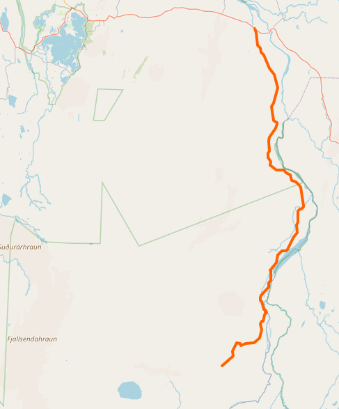
F26 - Iceland's longest highland road crossing central desert. Desolate route between Vatnajökull and Hofsjökull. 4x4 essential. Open July-September. Few facilities.
Öskjuleið
F88 - Route to Askja caldera. Remote highland adventure. Major river crossings. Challenging but rewarding.
Austurleið
F910 - Eastern highland route. Remote, challenging. Connects to Askja area.


Haukadalsskarðsvegur
F586 (Haukadalsskarðsvegur) is an easy mountain-pass road ending near Eiríksstaðir, a reconstructed farmstead associated with Leif Erikson's father. It's open to any 4x4 and has 2–3 small river crossings on record, none flagged as serious.

Flateyjardalsvegur
F899 (Flateyjardalsvegur) is a highland road in North Iceland's interior leading to a remote beach, rated medium difficulty and requiring at least a large 4x4. It has several small river crossings plus one larger crossing near the coast, and there's a campsite at the end.
25 F-roads in Highlands
200 kmSprengisandsleið
F26 - Iceland's longest highland road crossing central desert. Desolate route between Vatnajökull and Hofsjökull. 4x4 essential. Open July-September. Few facilities.
Kjalvegur
F35 - Kjölur highland route. Easier than Sprengisandur. Passes Hveravellir hot springs and Kerlingarfjöll. More accessible introduction to highlands.
Öskjuleið
F88 - Route to Askja caldera. Remote highland adventure. Major river crossings. Challenging but rewarding.
Kerlingafjallavegur
F347 - Route to Kerlingarfjöll mountain resort. Hot springs, hiking, accommodation.
Austurleið
F910 - Eastern highland route. Remote, challenging. Connects to Askja area.
Eyjafjarðarleið
F821 (Eyjafjarðarleið) climbs from sea level near Eyjafjörður up to roughly 926 m, one of the steepest coast-to-highland ascents among Iceland's F-roads. It's rated medium difficulty and needs at least a medium 4x4. The road ends at Laugafell, where there's a natural hot spring.
Skagafjarðarleið
F752 (Skagafjarðarleið) is the northern approach into the F26 Sprengisandur route, rated hard difficulty and requiring a large 4x4. It crosses the Hnjúkskvísl, a glacial river carrying rock flour, and sees noticeably less traffic than F26 itself.
Eysteinsdalsleið
F575 (Eysteinsdalsleið) is the last F-road on the Snæfellsnes peninsula, rated easy-to-medium and open to any 4x4. It's steep and narrow in places but has no river crossings on record, and connects with F570 to form a highland loop on the peninsula.
Haukadalsskarðsvegur
F586 (Haukadalsskarðsvegur) is an easy mountain-pass road ending near Eiríksstaðir, a reconstructed farmstead associated with Leif Erikson's father. It's open to any 4x4 and has 2–3 small river crossings on record, none flagged as serious.
Svörtutungur
F734 (Svörtutungur) is an extreme-difficulty alternative to F35 (Kjölur), rated super-jeep-only. It has two major river crossings noted at over 80 cm deep with strong current — well beyond what a standard rental 4x4 is built for.
Þjófadalavegur
F735 (Þjófadalavegur) is an easy side trip off F35 near Hveravellir, leading into a valley referred to on record as 'thief's valley.' It's open to any 4x4, and no water crossings are noted on record — the main factor is remoteness.
Dragaleið
F881 (Dragaleið) is an easy connector road in central Iceland, linking F26, F752, and F821. It's open to any 4x4, and no water crossings are noted — the road exists to join those three routes rather than to reach a destination of its own.
Flateyjardalsvegur
F899 (Flateyjardalsvegur) is a highland road in North Iceland's interior leading to a remote beach, rated medium difficulty and requiring at least a large 4x4. It has several small river crossings plus one larger crossing near the coast, and there's a campsite at the end.

Kverkfjallaleið
F902 - Route to Kverkfjöll ice caves and hot springs. Very remote.

Hvannalindavegur
F903 (Hvannalindavegur) leads to Hvannalindir, a green oasis inside the black volcanic desert of the interior. It's rated medium difficulty, needs at least a medium 4x4, and has two river crossings plus sandy stretches.

Arnardalsleið
F905 (Arnardalsleið) is an easy scenic route into Askja via F910, open to any 4x4. It crosses gravel, clay, rock, sand, and sulfur terrain in one drive, with no major river crossings noted.
Austurleið connector
F907 (Austurleið connector) links sections of the eastern highland road network, rated easy and open to any 4x4. Only small ponds are noted along the way — no significant river crossings.

Snæfellsleið
F909 (Snæfellsleið) leads to Iceland's highest driveable point, near Snæfell mountain in the eastern highlands. It's rated hard difficulty, requires at least a large 4x4, and has multiple glacial river crossings.

Jökuldalsvegur
F923 (Jökuldalsvegur) is a medium-difficulty road near the Stuðlagil basalt canyon, requiring at least a medium 4x4. It has two river crossings, and September can bring snow on this route even though it's still technically open.
Loðmundarfjarðarvegur
F946 (Loðmundarfjarðarvegur) is a hard-rated mountain road leading to an isolated fjord cabin, requiring at least a large 4x4. No river crossings are noted — the difficulty comes from steep, narrow terrain and the road's remoteness.

Viðfjarðarvegur
F959 (Viðfjarðarvegur) is a narrow mountain pass to an empty fjord, rated hard difficulty and requiring at least a large 4x4. There's a cliff on one side of the track and a drop on the other, and passing an oncoming vehicle means one of you reverses — sometimes a long way.
Kollumúlavegur
F980 (Kollumúlavegur) includes one of the deepest river crossings among Iceland's highland roads, the Skyndidalsá, and is rated extreme difficulty — super jeep only. Many drivers turn back at the crossing rather than attempt it.
Jökulvegur
F985 (Jökulvegur) is a hard-rated zig-zag climb to a glacier edge, on record as having more switchbacks than any other F-road. It requires at least a large 4x4, and no river crossings are noted — the challenge is the sustained switchback climb and the heights involved.
Cars & campers
 KEF airport pickup 24/74.8
 Transmission
 Fuel
Fuel Seats
Seats Drive
Drive

 Sleeps
Tours near Highlands
 Small groups
 Duration
 Highlights
 Type
Type
