


Iceland's Ring Road
Route 1 — the legs with real distances, today's road status, and what fuel costs right now.

The Ring Road is Route 1, the single paved road that makes a complete loop around Iceland — roughly 1,300 km, though published figures disagree. It is paved the whole way and needs no 4x4; the highland F-roads that do are a separate network. Most of Iceland's best-known sights sit on it or within a short detour, which is why the loop is the default shape of an Iceland road trip.
Right now: Reported open, 76 stretches reported. See which stretches →
The loop, leg by leg
Distances below come from our own road-authority route data. Two legs carry no number: we do not hold a sourced figure for the east fjords or the north-east run, and a guessed distance on a road trip is worse than no distance at all.
- Reykjavík → Vík — 186 km, ~2.5 h
Seljalandsfoss, Skógafoss and Reynisfjara all sit on this leg. The stretch under Eyjafjöll is one of the windiest roads in Iceland. - Vík → Jökulsárlón — 184 km, ~2–2.5 h
Derived: Jökulsárlón is 370 km from Reykjavík, Vík is 186. Sand plains, then the glacier tongues. - Jökulsárlón → Egilsstaðir — distance not held
The east fjords. We do not hold a road-authority figure for this leg, so we do not print one. - Egilsstaðir → Akureyri — distance not held
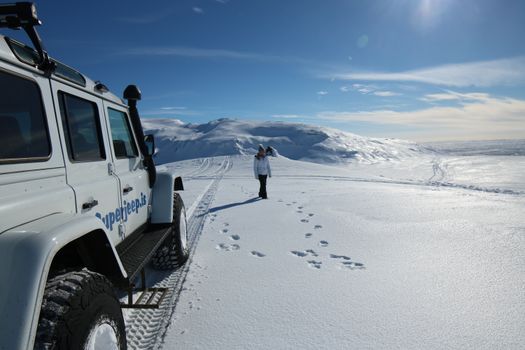
Across the north-east, past Mývatn and Námafjall — the view in the photograph above. No sourced figure held. - Akureyri → Reykjavík — 388 km, ~5 h
The north-west run home over Öxnadalsheiði and Holtavörðuheiði — the two passes that close first in winter.
Fuel on the loop, today
The cheapest petrol in Iceland right now is 232.3 ISK/L at Costco Iceland Kauptún. Prices move daily and rise away from the capital area, so the cheap fill is the one you take before a long empty leg, not on it. All 247 stations, live →
Cars & campers
 KEF airport pickup 24/74.8
 Transmission
 Fuel
Fuel Seats
Seats Drive
Drive

 Sleeps
Ring Road — questions people actually ask
Do you need a 4x4 for the Ring Road?
Which way round should you drive the Ring Road?
Is the Ring Road open all year?
How much does fuel cost around the Ring Road?
How long is Iceland’s Ring Road?
Hero photograph: Route 1 below Námafjall by Jakub Hałun, CC BY 4.0, via Wikimedia Commons. Road status: Vegagerðin. Fuel prices: gasvaktin.is. Distances: our own route data.