

Iceland Highlands Itinerary: 5 Days
Landmannalaugar, Kjölur, Kerlingarfjöll, Þórsmörk — and the live open-or-closed status of every F-road the plan drives.
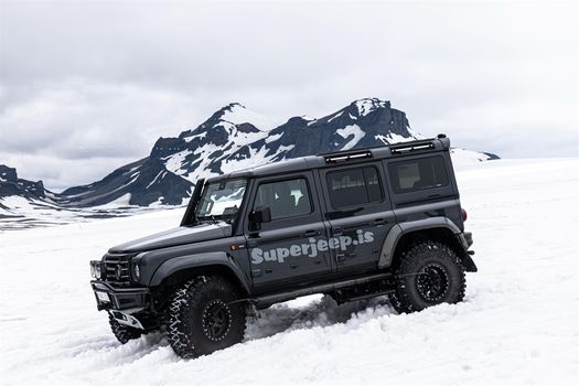
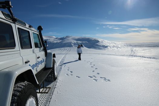
Five days is enough for the accessible highlands: Landmannalaugar for two, the Kjölur route and Kerlingarfjöll for one, the Golden Circle on the way down, and Þórsmörk if the Krossá lets you. All of it needs a 4x4 by law, all of it is summer-only, and none of it is guaranteed open on the day you arrive — which is why the live status of each road is right below.
The F-roads this plan drives — status right now
Live from Vegagerðin’s own feed, scoped to the seven highland roads used below. A road missing from this table is one the authority is not currently reporting — that is not the same as open. The full national list is on F-roads of Iceland.
6 of this plan’s highland roads reported · 1 closed or closed in places · Vegagerðin, updated 11 h ago
| F-road | Status now | Vegagerðin's wording |
|---|---|---|
| F210 Fjallabaksleið syðri | Impassable | Ófært |
| F26 Sprengisandsleið | Open to 4x4s | Fært fjallabílum |
| F208 Fjallabaksleið nyrðri | Open to 4x4s | Fært fjallabílum |
| F225 Landmannaleið | Open to 4x4s | Fært fjallabílum |
| F249 Þórsmerkurvegur | Open to 4x4s | Fært fjallabílum |
| F347 Kerlingafjallavegur | Open | Greiðfært |
Why the highlands are a different trip
The interior is not a scenic detour off the Ring Road; it is a separate country with its own opening hours. There are no towns, no fuel, no phone signal for long stretches, and no tarmac. Distances that look trivial on a map take three times as long, because 60 km/h is optimistic on washboard gravel and the fords do not care about your schedule.
It is also the part of Iceland that most rewards going. Landmannalaugar’s rhyolite is genuinely the colour the photos claim, and by evening the day-trippers have gone and there are perhaps forty people in the entire basin.
Every other highlands guide on this search tells you the roads open “around late June” and leaves it there. That is the seasonal pattern, not an answer. Vegagerðin opens each F-road on its own date after snowmelt, and in a cold year that is weeks later than the pattern suggests. The table above is what is actually true today.
The five days, with today’s conditions
Daylight today (23 September 2026), Landmannalaugar: 12 h 19 m of daylight, sunrise 06:59, sunset 19:18. That is how many hours each day below actually has.
- Day 1Reykjavík to Landmannalaugar
Out on Route 1, then road 26 up the Þjórsá valley, then F208 south into Fjallabak. It is about 180 km and three and a half to four hours, and the last hour of it is the part that matters: gravel, washboard, and a couple of shallow fords on the northern approach. Take the northern F208 from road 26. The southern approach and F210 have unbridged crossings that are genuinely Land Cruiser territory.
Fill the tank at Hella or Hvolsvöllur. There is no fuel in the interior — none, not at Landmannalaugar, not at Hveravellir — and the next pump after you turn off road 26 is the one you came from. Our fuel price index has what a tank costs and where the stations actually are.
Landmannalaugar: Good to go · 180 km · ~3.5–4 h from Reykjavík
Sleep: Landmannalaugar hut or campsite
- Day 2Landmannalaugar on foot
No driving today, which is the point of basing here. Brennisteinsalda and the Laugahraun lava field are a half-day loop from the hut; Bláhnjúkur adds a steep hour for the view over the whole rhyolite basin. The Laugavegur trail starts here and runs roughly 55 km south to Þórsmörk, normally over four days with hut nights — if that is your trip, this is where it begins rather than a day you fit in.
The bathing stream beside the campsite is the reason the place is called “the people’s pools”. It is warm where the hot and cold streams meet and cold two metres away, so wade until it is right.
A walking day — we publish no road verdict for it. What matters is whether you can still drive out tomorrow: the live F-road table above is the answer.
Sleep: Landmannalaugar
- Day 3North to Kjölur and Kerlingarfjöll
Back out on F208 to road 26, then across to F35 — the Kjölur route, the gentlest of the three highland crossings and the one most mid-size 4WDs handle without drama. Hveravellir sits at the halfway point with steaming ground and a hot pool; Kerlingarfjöll is the detour worth making, an orange geothermal massif up F347.
F35 is graded gravel with no major fords, which is why it opens earliest and closes latest. It is still an F-road: 4WD is required by law, and driving it in a 2WD voids your rental insurance completely.
F35 and F347 are not corridor-scoped in our route data, so we publish no single verdict for this leg — their live open or closed status is in the table above, straight from Vegagerðin.
Sleep: Kerlingarfjöll or Hveravellir
- Day 4Down to Gullfoss and the Golden Circle
F35 spits you out at Gullfoss, which after three days of gravel feels like arriving in a city. Do the Golden Circle backwards from there — Gullfoss, Geysir, Þingvellir — and you will be driving against the tour-bus flow all day.
This is the first fully paved day of the trip, and the verdict below is scoped to that loop alone. If you want the comparison with the other classic day out, we have Golden Circle vs South Coast.
Golden Circle: Good to go · 250 km · 3–4 h round trip
Sleep: Hvolsvöllur, to set up day 5
- Day 5Þórsmörk, and the ford that decides it
Þórsmörk sits between three glaciers and is reached on F249 — a road with a reputation, because it ends at the Krossá, an unbridged glacial river that changes depth through the day and swallows rental 4x4s every summer. Most rental agreements exclude water damage outright, so this is one crossing where the honest answer is often “take the highland bus”.
If you do drive it, go in the morning when meltwater is lowest, and never enter a ford without watching another vehicle cross first. Read river crossings in Iceland before you commit — it is the difference between a fun day and a five-figure bill.
F249 is not corridor-scoped in our route data, so we publish no verdict for this leg. Its live status is in the table above — and even an open F249 says nothing about the Krossá depth on the hour you arrive.
Sleep: Back to Reykjavík, or Hvolsvöllur again
Each driving day's verdict is live and scoped to that route only, verified 23 September, 00:44 Iceland time. Source: Vegagerðin (road.is). Distances and drive times are Vegagerðin figures, rounded. Daylight is computed from the standard sunrise equations for Landmannalaugar. Days without a scoped corridor say so rather than showing a status we do not hold.
| Day | Route | Driving distance | 4x4 |
|---|---|---|---|
| Day 1 | Reykjavík → Landmannalaugar (26, F208) | ~180 km | Required |
| Day 2 | Landmannalaugar on foot | No driving | Required to be there |
| Day 3 | Landmannalaugar → Kjölur → Kerlingarfjöll (F35, F347) | ~150 km | Required |
| Day 4 | Kerlingarfjöll → Gullfoss → Golden Circle | ~250 km | No — paved |
| Day 5 | Þórsmörk and back (F249) | ~120 km | Required, plus a ford |
Day 1 distance and drive time are Vegagerðin figures. The interior legs are approximate: highland driving speeds vary enough with surface and weather that a precise number would be a false one. Budget more time than the kilometres suggest.
The highland rules that are not negotiable
4WD is a legal requirement, not a recommendation. Every road with an F prefix requires four-wheel drive. A 2WD on an F-road voids your rental insurance completely — not partially — so a scraped sump becomes your bill, and so does the recovery that brings you out.
Water damage is excluded from essentially every rental policy. That is the single most expensive sentence in Icelandic car rental. A stalled engine in a ford is not covered by the gravel protection, the sand-and-ash protection, or the super collision waiver. Check river crossings before you enter one.
Off-road driving is illegal everywhere in Iceland. Not discouraged — illegal, with fines that run into six figures in krónur. Moss and highland vegetation take decades to recover from a single set of tracks. Stay on the road even when the road is bad.
There is no fuel in the interior. Fill up at Hella, Hvolsvöllur or Selfoss on the way in and treat the tank as your range limit for the whole crossing.
A closed road stays closed. Vegagerðin closes F-roads when the ground is too soft to survive traffic or the crossing is unsafe. There is no judgement call available to you at the sign. Check the live table above the morning you drive, and have a paved alternative in mind — the Golden Circle is the usual one.
Frequently
asked questions
When are the Icelandic highlands open?
Do I need a 4x4 for the Iceland highlands?
How many days do you need for the Icelandic highlands?
Can you drive to Landmannalaugar in a rental 2WD?
Is Þórsmörk worth the river crossing?
What happens if an F-road is closed when I arrive?
Cars & campers
 KEF airport pickup 24/74.8
 Transmission
 Fuel
Fuel Seats
Seats Drive
Drive

 Sleeps
Tours near the Icelandic highlands
 Small groups
 Duration
 Highlights
 Type
Type