



Hiking Safety in Iceland in Summer
Iceland's summer trails are rarely technical. What catches people out is weather that turns within the hour, rivers that rise through the day, and getting cold at temperatures that do not sound cold.
Iceland's summer trails are safe if you check the forecast and carry windproof, waterproof layers — and dangerous if you do not. The hazard is exposure, not difficulty: weather turns within the hour, and there is no shelter. Check conditions before every walk, file a travel plan at safetravel.is, and turn back when it changes.
Ring Road (R1) openHighlands: 56 of 64 monitored roads closed or impassableVegagerðin, updated just now
Conditions at the trailheads right now
Live readings taken at the trailheads themselves, not the nearest town — because the weather at Landmannalaugar is not the weather in Reykjavík. Watch the gap between the air temperature and the feels-like figure: that gap is the wind, and the wind is what makes a 10°C day dangerous. Tap a trailhead for the trail itself.
- LandmannalaugarLaugavegur trailhead · interior highlands
2°C airfeels like-7°Cwind12m/s(gusts 17)Clear skywind chill takes off9°C
- ÞórsmörkLaugavegur south end · Fimmvörðuháls finish
4°C airfeels like1°Cwind4m/s(gusts 10)Overcast
Open-Meteo, updated just now · readings taken at each trailhead's own coordinates, not the nearest town · daylight in the south today 08:18–18:09 (9 h 51 m, computed)
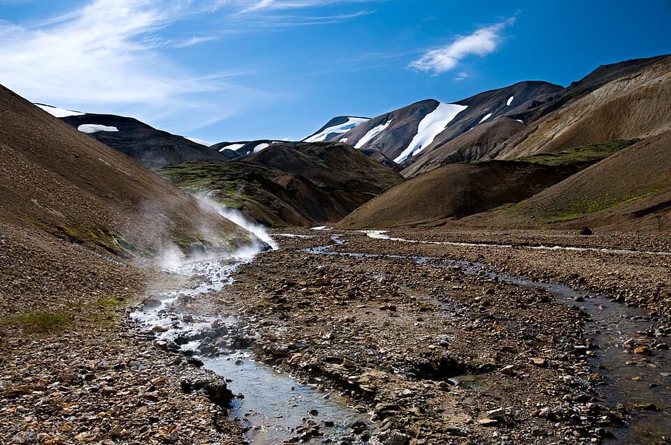
Most people who get into trouble hiking in Iceland are not doing anything reckless. They are on a marked trail, in summer, on a route that thousands of people walk every year. The trails themselves are rarely technical. What makes them serious is the combination of three things: the weather changes faster than anywhere most visitors have hiked before, there is no tree cover and almost no shelter, and once you are in the interior you are a long way from help.
This guide is about that specific gap — between how an Icelandic summer hike sounds and what it actually asks of you. It covers what goes wrong, how to read the conditions before you start, and when to turn around. It is deliberately plain. For the drive to the trailhead, read wind and storm driving in Iceland — this page is about walking.
How far from help you actually are
The interior holds the big trails — the Laugavegur, Fimmvörðuháls, Kerlingarfjöll. There are no roads across most of this, no phone signal for long stretches, and hours between huts. Open the map to see the trailheads and the roads in.
The weather turns within the hour
SafeTravel — the travel-safety service run by ICE-SAR, the Icelandic Association for Search and Rescue — tells hikers to check the weather every day, and even twice a day, because sudden changes can be drastic even in summer. That is not a formality. A clear morning at a trailhead tells you very little about a high, open ridge three hours later.
In June 2004 a 25-year-old Israeli hiker, Ido Keinan, set out from Landmannalaugar onto the Laugavegur as a storm moved in. The wardens had warned him it was too dangerous to go, and that his cotton clothes and light shoes were not enough. He died of exposure one kilometre from the Hrafntinnusker hut, on a leg of the trail that is twelve kilometres long. Around seventy people from the Hella rescue team searched for him. His death was reported by the Reykjavík Grapevine, and a memorial stands near where he was found. This was late June, on a marked, popular trail.
The lesson is not that the Laugavegur is a dangerous trail. It is that in Iceland the decision to start is the decision that matters, and the people best placed to make it — the wardens on site, the forecast, the warning in force — are worth listening to over your own schedule.

Exposure at temperatures that do not sound cold
This is the hazard that does the most damage, because it does not announce itself. An Icelandic summer day is often around 10°C. That number sounds mild, and people dress for it as though it were mild. But hypothermia does not need freezing conditions — it needs you to be wet, exposed to wind, and unable to warm back up. Iceland supplies all three routinely, and the Icelandic Met Office describes the highland interior as substantially colder than the coast where you started your drive.
Look again at the live readings at the top of this page. The gap between the air temperature and the feels-like figure is the wind doing its work, and on an exposed ridge that gap is routinely large enough to turn a pleasant number into a serious one. Add rain, and wet clothing loses most of its insulating value — cotton especially, which is why the wardens singled it out. This is the entire mechanism: mild-sounding air, wind, water, no shelter, and hours to walk.
The defence is unglamorous and it is the same one SafeTravel gives: windproof and waterproof outer layers, a hat and gloves, no cotton against the skin, and food. Carry them even when the trailhead is sunny — the whole point is that the trailhead is not where you will need them.
| Hike | What to carry | Why it matters in summer |
|---|---|---|
| Short hike (a few hours, marked trail) | Hat, gloves, and a windproof + waterproof jacket and trousers. Proper footwear, not trainers. | SafeTravel is explicit that even on a short walk the weather can turn from fine to serious in a few minutes. The clothing is the whole margin. |
| Full-day hike | The above, plus a map and compass, a GPS or an offline map downloaded to your phone, a power bank, food and water. | Phone maps fail when the signal drops and the battery dies faster in the cold. An offline map with no charge left is not a map. |
| Multi-day trek (Laugavegur, Fimmvörðuháls, the interior) | All of the above, a travel plan left with SafeTravel and with someone you trust, and the 112 Iceland app. SafeTravel suggests considering a rented PLB or satellite messenger. | In the interior there is no phone signal for long stretches and no shelter between huts. A filed travel plan is what tells rescuers where to start looking. |
This is not our packing list — it is what SafeTravel tells hikers to take, and SafeTravel is run by the people who come and find you. Our own packing guide covers the rest of a trip; for a hike, the layers and the map are the parts that are not optional.
Rivers rise through the day
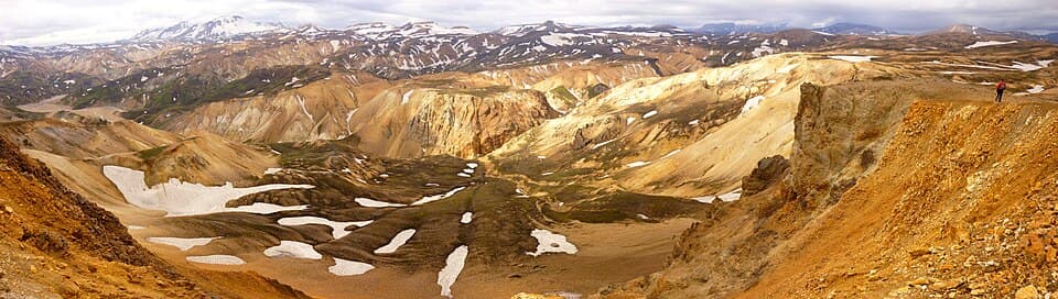
Unbridged river crossings are a normal part of the big interior trails, and they are the hazard people most often misjudge, because a river is not a fixed obstacle. Glacial rivers are fed by melt: they swell through the day as the sun works on the ice, and again after rain. The crossing that was knee-deep and easy at nine in the morning can be a different proposition at four in the afternoon. SafeTravel notes that rivers generally have lower water levels in the morning — plan the crossing for early, not for whenever you happen to arrive.
SafeTravel's crossing guidance is to go two or three at a time, clasping arms together at the elbows, so the group is one stable unit rather than three unstable ones. Undo your pack's waist strap first so you can shed it if you go in. Face upstream, move deliberately, and do not cross water you cannot see the bottom of. If the river looks wrong, it is wrong: wait, walk upstream to find a wider and shallower braid, or turn around. No summit is worth a glacial river in spate.
The ground itself: geothermal areas and loose terrain
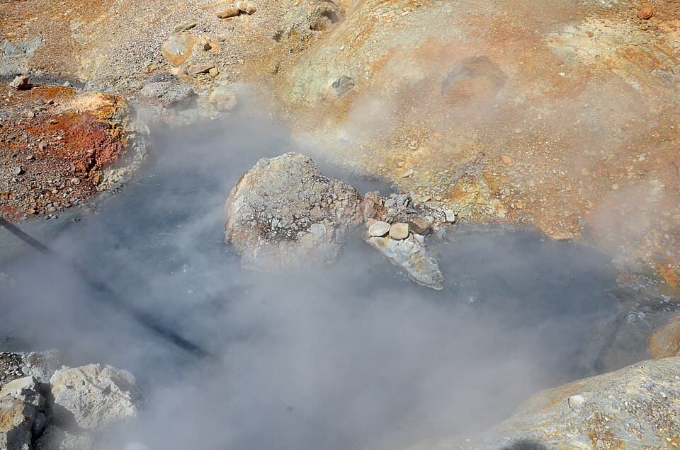
Several of Iceland's most-walked trails run through active geothermal ground — Reykjadalur above Hveragerði, the Hveradalir area in Kerlingarfjöll, and stretches of the Laugavegur. The water in these features is not warm, it is near boiling, and the crust around them can be thin enough to break under a boot. The marked path exists because someone worked out where the ground holds. Stay on it, and keep children and dogs close.
The other terrain hazard is more mundane: much of Iceland is loose volcanic scree and young lava, which moves under you and is hard on ankles. Add wet moss over rock, and a rolled ankle five hours from the trailhead becomes a rescue rather than an inconvenience. Boots with ankle support and a genuine sole are not fussiness here, and trainers on the marked-but-rough trails are how a lot of otherwise fine days end.
The roads in, right now
Live frames from the roads that reach the main hiking areas. They will not show you the trail, but they will show you the weather that is sitting on it — and whether the drive in is even happening today. If none load, the feed is down: treat that as a reason to check the alerts page, not as an all-clear.
 Live
Live Live
Live Live
Live Live
LiveMost Icelandic trailheads are gated by a drive, and the interior ones are gated by F-roads that open only for a short summer window and need a 4WD. Check whether you can even get there with the can-I-drive tool, and read the full forecast and any warnings on the alerts page before you commit to a day in the highlands.
Should I start this hike today? A go/no-go read
Work down the list. The first “yes” is your answer.
Is a weather warning in force for the area, or is the forecast for the hours you would be out worse than the conditions you can comfortably walk in?
Do not startDo not start. Icelandic weather can turn from fine to dangerous within the hour, and a warning is issued because the conditions are expected to exceed what people can handle. Walk it another day.
Does the live feels-like temperature at your trailhead sit near or below freezing, and you do not have a windproof shell, hat and gloves with you?
Do not startDo not start. SafeTravel tells hikers to carry a hat, gloves and windproof, waterproof layers even on short summer walks. Wet cotton and wind is the exact combination that causes hypothermia in Iceland in July.
Does your route cross an unbridged river, and is it afternoon on a warm or rainy day?
Start only with careReconsider, or wait for morning. Glacial rivers rise through the day as meltwater and rain reach them; SafeTravel notes water levels are generally lower in the morning. Never cross a river you cannot see the bottom of.
Are you heading into the highlands or onto a multi-day trail without a travel plan filed and the 112 Iceland app installed?
Start only with careDo that first — it takes minutes. A travel plan left with SafeTravel and with someone you trust is what tells rescue teams where to look. The 112 app can send your GPS position to emergency services.
All of the above “no”?
Good to goNo warning, conditions you are dressed for, and someone knows your plan — you are good to walk. Re-check the forecast before you set off and again if the sky changes: the conditions at the trailhead are not a promise about the ridge two hours in.
The checks to run before you walk
None of this takes long, and it is the difference between the hikers who have a good day and the ones the rescue teams go looking for. Run these before every walk, not just the big ones.
#1.Read the forecast for the hours you will be out — not for right now
cadence: check daily, even twice dailywhat to read: feels-like, not air temp
Start with the live trailhead readings at the top of this page, then get the full forecast and any warnings on the alerts page. Read the feels-like figure and the wind, not just the temperature, and read them for the hours you will actually be on the exposed ground. SafeTravel's guidance is to check every day and even twice a day, because it changes that fast.
#2.File a travel plan and install the 112 app
register: travel plan at safetravel.isemergency: emergency number 112
For anything in the highlands or overnight, leave a travel plan with SafeTravel and with someone you trust, and update it if your plans change. Install the 112 Iceland app, which can send your GPS position to emergency services. A travel plan is what turns a search of the entire interior into a search of one valley.
#3.Carry the layers even when the trailhead is sunny
gear: windproof + waterproof shellgear: hat, gloves, no cotton
SafeTravel says to take a hat, gloves and windproof, waterproof jacket and trousers even on a short hike. The trailhead weather is not the argument — the ridge weather is, and you cannot go back for a jacket from there. Add a map and compass or an offline map and a power bank for anything longer than a couple of hours.
#4.Plan river crossings for the morning
timing: lower water in the morningtechnique: cross linked, 2–3 at a time
If your route crosses unbridged water, do it early, before the day's melt comes down. Cross two or three at a time with arms linked at the elbows, waist strap undone, and never into water you cannot see the bottom of. If it looks wrong, walk upstream or turn around.
#5.Set a turnaround time, and keep it
daylight: daylight shown live abovediscipline: turning back is the skill
Summer daylight is long — the computed sunrise and sunset for today sit in the live strip above — and that length is exactly what tempts people into starting late or pushing on. Decide before you leave what time you turn around regardless of how close the summit looks, and hold to it. Weather, not darkness, is usually what makes the second half of an Icelandic hike harder than the first. For the long-daylight picture, see the midnight sun.
If it goes wrong
Iceland's emergency number is 112. The 112 Iceland app can send your GPS location to emergency services, which is the fastest way for a rescue team to find you — install it before you need it, not while you need it.
If the weather closes in or you lose the trail, stop. Hypothermia takes your judgement before you notice it going, so the decision to shelter has to be made while you can still make it well. Get out of the wind, put on every layer you have, eat, and get off wet ground. If you are with people, stay together. If someone has filed your travel plan, rescuers already have a place to start.
None of this is a reason not to hike in Iceland. The trails are worth it, and most days on them are straightforward. It is a reason to check the conditions before every walk, carry the layers you probably will not need, tell someone where you are going, and be willing to turn around. The hikers who get into trouble are almost always the ones who assumed instead of checking.
Frequently
asked questions
Is hiking in Iceland dangerous?
What is the biggest danger when hiking in Iceland in summer?
Can you get hypothermia hiking in Iceland in July?
What should I pack for a summer hike in Iceland?
Is the Laugavegur trail safe?
How do I check the weather before a hike in Iceland?
How do I cross a river safely when hiking in Iceland?
What do I do if something goes wrong on a hike in Iceland?
Getting to the trailheads
Almost every trail on this page starts at the end of a drive, and the interior ones — Landmannalaugar, Kerlingarfjöll, Þórsmörk — are reached only by F-roads, which are 4WD-only by law and open for a short summer window. A mid-size 4x4 covers the easier highland roads; the routes with unbridged river crossings need something rated to ford, like a Land Cruiser. See do you need 4WD in Iceland for the full answer.
Cars & campers
 KEF airport pickup 24/74.8
 Transmission
 Fuel
Fuel Seats
Seats Drive
Drive

 Sleeps
Tours near Iceland's hiking trails
 Small groups
 Duration
 Highlights
 Type
Type
