



Best F-Roads in Iceland, Ranked
The flagship highland routes from easiest to hardest — the 4WD each needs, the rivers to respect, and whether they're open right now.
Start with F35 Kjölur, the easiest flagship F-road. Step up through F208 / F224 to Landmannalaugar and F88 to Askja, then F26 Sprengisandur, Iceland's longest. F249 to Þórsmörk is super-jeep only. All need 4WD by law and open only in summer.
How many F-roads are open in Iceland right now?
2 of 40 F-roads tracked by umferdin.is are open right now and 7 are closed (31 not currently reporting). Per-road status is in the table below — always check conditions on the day you drive.
Data verified 16 October 2026, 07:39 · source: umferdin.is (Vegagerðin, the Icelandic Road Administration) · refreshes every 10 minutes
Ring Road (R1) slippery in placesHighlands: 56 of 64 monitored roads closed or impassableVegagerðin, updated just now
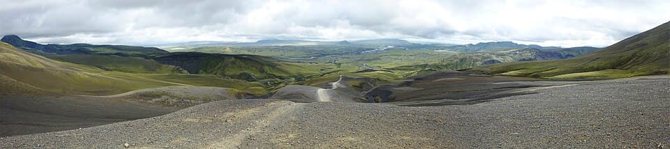
F-roads are Iceland's highland mountain tracks — the “F” is for fjall, mountain. There are 51 of them in our F-roads dataset (sourced from Vegagerðin, the Icelandic Road Administration), and they all share three things: 4WD is required by law, they open only in summer once the snow clears and the rivers drop, and most cross unbridged rivers that rise and fall through the day. If you're still deciding whether you need a 4WD at all, read do I need 4WD in Iceland first, or what are F-roads in Iceland for the basics.
This guide ranks the flagship routes from easiest to hardest, so you can match a road to your vehicle and your nerve. The ranking follows the difficulty and minimum-vehicle ratings in our dataset, not opinion. Every road here has hand-written content on its own page, and every row in the table below links to it.
Where the F-roads live
The interior is a web of F-roads radiating from the icecaps. Open the map to see how the flagship routes connect — and where the tarmac ends.
| F-road | Difficulty | Minimum 4WD | Length | Open now? |
|---|---|---|---|---|
| F35 Kjalvegur (Kjölur) | Easy | Any 4x4 | 168 km | Check live |
| F208 Fjallabaksleið nyrðri | Varies | Any 4x4 north / medium 4x4 south | — | Not reported |
| F224 Landmannalaugavegur | Medium | Medium 4x4 | — | Not reported |
| F206 Lakavegur (Laki) | Medium | Medium 4x4 | — | Not reported |
| F88 Öskjuleið (Askja) | Medium–hard | Medium 4x4 | — | Impassable (varies) |
| F910 Austurleið | Medium east / hard west | Medium 4x4 east / large 4x4 west | — | Not reported |
| F26 Sprengisandsleið | Hard | Large 4x4 | 200 km | Impassable (varies) |
| F210 Fjallabaksleið syðri | Hard | Large 4x4 | — | Impassable (varies) |
| F249 Þórsmerkurvegur | Extreme | Super jeep only | — | Open to 4x4s |
Difficulty, minimum-vehicle and length values come straight from our F-roads dataset. Only F26 and F35 carry a published length in that dataset, so the rest read “—” rather than a guessed figure — open the road's page for its full detail. The Open now? column is live from Vegagerðin — the same per-road feed each road's own page renders. A road the feed does not currently report shows a plain link instead of a guessed status; for a specific route on a specific day, the Can I drive there today tool gives a route-by-route verdict.
Every F-road requires 4WD by law, and 2WD cars are banned from them. Driving an F-road in a 2WD voids your rental insurance and makes you personally liable for any damage — match the car to the route from the start.
River crossings are never covered by rental insurance. Most of these roads cross glacial rivers with no bridge, and those rivers rise through the day as the ice melts. Cross in the morning when the water is lowest, walk a crossing before you drive it, and if the water is above your knees on foot, wait. Getting stuck mid-river on a remote route can cost thousands in recovery — F210's Holmsá and F249's Krossá are the ones that catch people out.
F-roads open only in summer, and the exact dates move every year with the snowmelt. Don't assume a road is open just because it's July — check the live status on the F-roads hub and the alerts page before you plan an interior day, and run the pre-drive live checks.
The flagship F-roads, road by road
Nine routes, ranked easiest to hardest. Each one links to its full page, and the minimum-vehicle note tells you when to stop stepping up the fleet.
#1.F35 Kjalvegur — the one to start with
difficulty: Easyminimum vehicle: Any 4x4length: 168 km
F35 (Kjölur) crosses the interior between the Langjökull and Hofsjökull icecaps and is the gentlest of the flagship F-roads — our dataset rates it “easy” with “any 4x4” as the minimum, because it has no major unbridged crossings. It passes the Hveravellir hot springs and Kerlingarfjöll, which makes it the usual first taste of the Highlands. A budget crossover like a Dacia Duster or Suzuki Vitara handles it.
#2.F208 Fjallabaksleið nyrðri — the Landmannalaugar road
difficulty: Variesminimum vehicle: Any 4x4 north / medium 4x4 southnote: river crossings
F208 runs through the rhyolite mountains of the northern Fjallabak to Landmannalaugar — one of the most scenic routes in the country, and the classic reason to rent a 4WD. The dataset's own field notes are blunt about the crossings: the two rivers before the campsite are lowest in the morning, so walk them first, and water above your knees means wait. The northern approach is rated for any 4x4; the southern section wants a medium 4x4.
#3.F224 Landmannalaugavegur — the southern spur
difficulty: Mediumminimum vehicle: Medium 4x4note: river crossings
F224 is the southern access to Landmannalaugar, rated medium with a medium 4x4 minimum. Its crossings catch people off guard after rain — you can park before the rivers and walk in, which many people do. Pair it with F208 for the full Fjallabak picture, and read how Iceland numbers its roads if the F-number system is still new to you.
#4.F206 Lakavegur — the Laki craters
difficulty: Mediumminimum vehicle: Medium 4x4note: long day
F206 reaches the Laki craters, the row of vents that erupted in 1783 in one of the largest lava outpourings in recorded history. It's a rough route through lava fields, rated medium for a medium 4x4. The dataset's field note is a distance warning: the craters look close on a map but the full crater-row hike is an eight-hour-plus day, so bring far more water than you think and start early.
#5.F88 Öskjuleið — the road to Askja
difficulty: Medium–hardminimum vehicle: Medium 4x4note: major crossings
F88 is the northern route to the Askja caldera — a remote highland adventure with major river crossings, rated medium-hard for a medium 4x4. The Lindaá river is the one to judge: locals shrug at it, first-time visitors freak out, so check levels on road.is before you commit. If you're unsure, the eastern approach via F910 avoids Lindaá entirely.
#6.F910 Austurleið — the long eastern crossing
difficulty: Medium east / hard westminimum vehicle: Medium 4x4 east / large 4x4 westnote: no fuel, no signal
F910 is an eastern highland route that connects toward the Askja area — remote enough that the dataset warns the full east-west run is around 150 km with nothing in between. Carry at least 20 extra litres of fuel, expect no cell signal in the middle, and tell someone your plan before you leave. Fill up at the last gas station on the way in; there are none once you're on it.
#7.F26 Sprengisandsleið — the longest crossing
difficulty: Hardminimum vehicle: Large 4x4length: 200 km
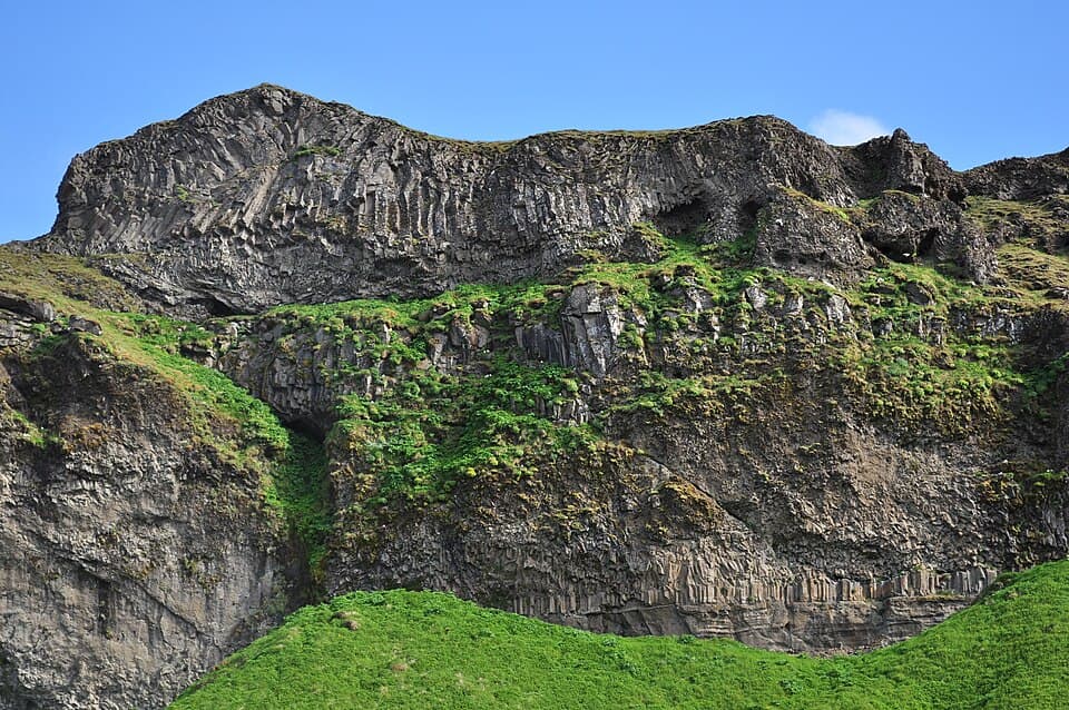
F26 (Sprengisandur) is the longest highland road in the country at around 200 km, crossing the desolate central desert between the Vatnajökull and Hofsjökull icecaps. It's rated hard, needs a large 4x4, and has very few facilities. The dataset's field notes matter here: your car drinks roughly twice the fuel on soft sand, cross rivers before 10am when the water is lowest, and stop at the Nýidalur hut to ask rangers about conditions — they know the ground better than any forecast. A Toyota Land Cruiser is the right tool.
#8.F210 Fjallabaksleið syðri — the remote southern route
difficulty: Hardminimum vehicle: Large 4x4note: unpredictable rivers
F210 is the southern Fjallabak route — less traffic and more remote than F208, rated hard for a large 4x4. The Holmsá river is the crux: it changes by the hour with glacier melt, so cross before noon or wait until evening. The dataset puts it plainly — getting stuck out here can cost upward of 3,000 dollars in rescue, and that isn't a joke. This is a route for confident highland drivers, not a first F-road.
#9. F249 Þórsmerkurvegur — extreme, super-jeep only. F249 reaches the Þórsmörk valley and is the hardest flagship route, rated “extreme” with a super-jeep-only minimum because of the Krossá river crossing, where many vehicles get stuck. Rental insurance does not cover Krossá. The honest advice, straight from the dataset's own notes: take the Þórsmörk bus. If you must drive it, follow a super-jeep convoy and copy their exact line through the water — and even then, think hard. This is not a road to attempt on your own judgment.
The highland-edge passes, right now
Live frames from the passes that gate the interior. A clear pass doesn't guarantee an open F-road behind it, but a snowed-in one is a straight answer — pair these with the live status line at the top.
 Live
Live Live
Live Live
Live Live
LiveCameras show you the actual surface at the passes; the live status line reflects the national Vegagerðin feed. For the full pre-drive routine — status, cameras, weather and the route verdict in order — see how to check Iceland road conditions. In winter, when the F-roads are closed entirely, read winter driving in Iceland instead.
Which 4WD for which F-road
The ranking maps neatly onto the fleet. For F35 and the easier Fjallabak approaches, a compact 4WD like a Suzuki Vitara or Dacia Duster has the clearance and grip you need without paying for a Highlands truck. For F208, F224, F88 and F206, a medium 4WD such as a Hyundai Tucson adds comfort and luggage room. For F26 Sprengisandur, F210 and anything with serious fords, step up to a Toyota Land Cruiser — the only class rated to cross rivers, and even then only after scouting on foot. A 4WD camper is an option for the easier routes if you want to sleep where you park. Whatever you rent, using code MAP for 12% off at car rental helps keep this platform free.
Frequently
asked questions
What is the easiest F-road in Iceland?
Which is the longest F-road in Iceland?
Which F-road has the hardest river crossing?
Do all F-roads require a 4WD?
When are Iceland F-roads open?
Can I drive F-roads in a rented 2WD car?
Which F-road should I take for Landmannalaugar?
How do I know if an F-road is open today?
Cars & campers
 KEF airport pickup 24/74.8
 Transmission
 Fuel
Fuel Seats
Seats Drive
Drive

 Sleeps
Tours near Iceland's highland F-roads
 Small groups
 Duration
 Highlights
 Type
Type
