



The Live Checks Locals Do Before Driving Iceland
Before an Icelander pulls onto Route 1 they run a short list of live checks. Here it is — each one a real feed you can read right now.
In one breath: check the live road status, look at the mountain-pass cameras, make sure you have the fuel to reach the next open pump, read the wind and weather warnings, and confirm your exact route is drivable today. If a road shows red, don't drive it. Every check below is a real live feed.
How many F-roads are open in Iceland right now?
2 of 40 F-roads tracked by umferdin.is are open right now and 7 are closed (31 not currently reporting). Per-road status is in the table below — always check conditions on the day you drive.
Data verified 16 October 2026, 07:29 · source: umferdin.is (Vegagerðin, the Icelandic Road Administration) · refreshes every 10 minutes
Ring Road (R1) slippery in placesHighlands: 56 of 64 monitored roads closed or impassableVegagerðin, updated just now
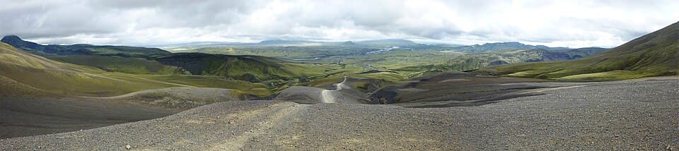
Driving in Iceland is not hard. It gets people into trouble because the conditions change faster than anywhere most visitors have driven — a calm morning turns into a sandstorm by lunch, a clear pass fills with snow in an hour, a river you forded yesterday is impassable today. The locals' edge isn't skill. It's that they check before they commit, every time, using the same live feeds this page is built from.
Run these seven checks the morning you drive — not the night before, and not from memory. They take about three minutes together.
One country, many microclimates
Route 1 loops the coast; the interior is a web of F-roads. Weather and road status differ wildly between them. Open the map to see roads and live conditions overlaid.
#1.Read the national road status
status: green / amber / redsource: live Vegagerðin feed
Start with the whole-country picture. The line below is the live Vegagerðin status for Route 1 and the highlands — green means open and clear, amber means care, red means don't. It carries the feed's own update time, not a made-up one. For the full national dashboard, open the pulse page.
Ring Road (R1) slippery in placesHighlands: 56 of 64 monitored roads closed or impassableVegagerðin, updated just now
#2.See the passes with your own eyes
element: live pass camerascadence: refresh ~10 min
A status colour is a summary. A camera is the truth. These are live frames from the mountain passes that gate the main corridors — if a pass looks white on camera, the road beyond it usually is too, whatever the forecast said an hour ago.
The passes, right now
Live frames from the passes that decide whether today is a driving day. If none load, the feed is down — treat that as a reason to check the alerts page, not as an all-clear.
 Live
Live Live
Live Live
Live#3.Fuel before you commit to the distance
rule: plan for the next open pumpdistance: gaps of 100 km+
Outside the southwest, petrol stations thin out fast — in the Westfjords, the east and the interior you can go 100 km or more between open pumps, and some close in the evening. The local habit is simple: never let the tank drop below half once you leave a town.
Cheapest bensín 95 right now: 241.2 kr/L — Costco Iceland · Kauptún, via gasvaktin.is. Prices barely move between brands; distance to the next open pump is what matters.
Compare every station and both fuels on the live fuel prices page before a long leg.
#4.Check the wind — it is the real hazard
threshold: ~15 m/s: car doors at riskthreshold: 20 m/s+: high-sided caution
Wind hurts more visitors than snow. From around 15 m/s a gust can rip an open car door out of your hand and bend it back — a common, expensive, often-uncovered rental claim, so open doors on the sheltered side and hold them. From roughly 20 m/s, campers and high-sided cars get shoved across lanes, and open gravel plains throw up grit that strips paint and blinds you. There is no honest single “live wind tile” to show here, so check the forecast properly on the alerts page before exposed stretches like the South Coast sands.
#5.Factor in darkness (and the aurora)
daylight: winter: ~4–5 h daylighttool: aurora forecast for night drives
In deep winter you get four or five hours of usable light, and unlit rural roads with ice and loose sheep are a different drive after dark. Plan legs to finish before dusk. If you're driving at night to chase the northern lights, read the live Kp and cloud-cover forecast on the aurora page first — and pull fully off the road to look, never stop on it.
#6.Confirm your exact route is drivable today
tool: route-scoped verdictsource: live segment status
A green country doesn't mean a green road under you. The can-I-drive tool scopes the live Vegagerðin status to one named route, so you get a straight yes/no for the drive you're actually doing — for example the Golden Circle or the South Coast to Vík. Heading into the interior instead? Check which F-roads are open first — they clear on their own schedule, long after summer starts.
#7.Scan the webcams along your way
element: live streams countrywidewhy: ground truth, not forecast
Last, look ahead. The webcams page gathers live streams from across the country, so you can see the weather where you're going, not just where you are. A clear sky over Reykjavík tells you nothing about a whiteout waiting on the far side of a fjord.
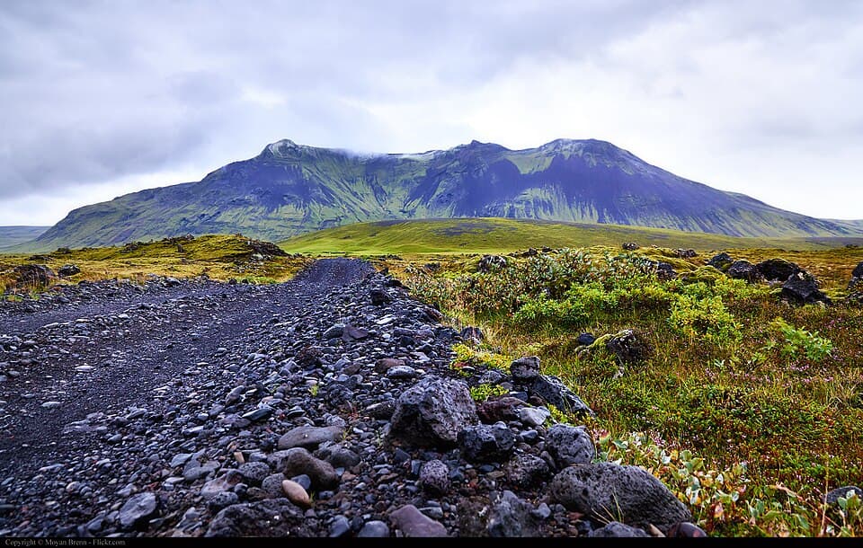
Take the conditions seriously — they kill people every year. The checks above exist because Iceland's roads combine hazards most drivers never meet at home, and they arrive without warning.
Wind is the first. Gusts on exposed coast and highland roads regularly top storm force; they flip high-sided vehicles, tear off doors, and drive sand and grit hard enough to strip paint and shatter visibility. Sudden weather is the second — sunshine to sleet to fog inside an hour is normal, and a road that was fine at breakfast can be closed by lunch, which is why you re-check before every leg, not once a day.
Then the road itself. Much of the Ring Road narrows to single-lane bridges — one car at a time, first to the bridge has right of way, so slow early and read the other driver. Gravel shoulders grab tyres and roll cars that drift onto them at speed. And sheep roam free all summer and stand in the road; they bolt unpredictably, and if you hit one you are liable to the farmer. Brake, don't swerve into the oncoming lane or the gravel.
None of this means don't drive. It means check first, keep the tank above half, slow down, and be willing to turn back. If the live feed says a road is red, that is not a suggestion — it is closed because the alternative has cost lives. Read it, and the alerts page, before you set off.
Frequently
asked questions
How do I check if it is safe to drive in Iceland today?
Where do I check Iceland road conditions?
Is it safe to drive in Iceland in winter?
What wind speed is dangerous for driving in Iceland?
Cars & campers
 KEF airport pickup 24/74.8
 Transmission
 Fuel
Fuel Seats
Seats Drive
Drive

 Sleeps
Tours near Iceland
 Small groups
 Duration
 Highlights
 Type
Type
