Generalstaben's Topografiske Afdeling - Copenhagen 1914 · Wikimedia Commons · Public domain
 Bauv19 · Wikimedia Commons · CC BY-SA 4.0
 Diego Delso · Wikimedia Commons · CC BY-SA 4.0
Westfjords Peninsulas

13 peninsulas in Westfjords — mapped with live road conditions, drive times, and directions.
13 peninsulas in Westfjords, led by Westfjords and Bjargtangar. All mapped with drive times, directions, and live road conditions.
Top peninsulas in Westfjords
The region's stand-outs — each with photos, facts, and its own page. Distances on the cards are straight-line from Reykjavík.

Westfjords
Not exactly a peninsula but a whole region of them. Iceland's remote northwest, where roads wind around countless fjords. Getting here takes commitment. The rewards are proportional. Dynjandi waterfall, Látrabjarg bird cliffs, and landscapes without tourist crowds. The ferry from Stykkishólmur shortcuts the driving. Either way, budget extra time. Westfjords can't be rushed.

Bjargtangar
Bjargtangar is the westernmost point of Iceland and is considered the westernmost point of Europe outside the mid-Atlantic archipelago of Azores. It is the westernmost point in the Greenwich Mean Time (GMT) time zone. Icelandic peninsula where land meets the Atlantic. Peninsula driving often takes longer than maps suggest - enjoy the journey.
13 peninsulas in Westfjords
Skálmanes
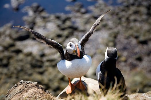
Icelandic peninsula where land meets the Atlantic. Bird colonies are common on peninsula cliffs - bring binoculars.
Strákatangi
Icelandic peninsula where land meets the Atlantic. Peninsula driving often takes longer than maps suggest - enjoy the journey.
Langeyri
Icelandic peninsula where land meets the Atlantic. The coastline varies dramatically - each peninsula has its own character.
Vattarnes
Icelandic peninsula where land meets the Atlantic. Bird colonies are common on peninsula cliffs - bring binoculars.
Sléttaeyri
Icelandic peninsula where land meets the Atlantic. Coastal roads can be affected by weather - check conditions before driving.
Spillir
Icelandic peninsula where land meets the Atlantic. Remote peninsulas may lack services - fuel and supply up in advance.
Ritur
Icelandic peninsula where land meets the Atlantic. Coastal roads can be affected by weather - check conditions before driving.
Horn
Icelandic peninsula where land meets the Atlantic. Bird colonies are common on peninsula cliffs - bring binoculars.
Horn
Icelandic peninsula where land meets the Atlantic. Bird colonies are common on peninsula cliffs - bring binoculars.
Blakknes
Icelandic peninsula where land meets the Atlantic. The coastline varies dramatically - each peninsula has its own character.

Drífa
Icelandic peninsula where land meets the Atlantic. Coastal roads can be affected by weather - check conditions before driving.
Westfjords
Not exactly a peninsula but a whole region of them. Iceland's remote northwest, where roads wind around countless fjords. Getting here takes commitment. The rewards are proportional. Dynjandi waterfall, Látrabjarg bird cliffs, and landscapes without tourist crowds. The ferry from Stykkishólmur shortcuts the driving. Either way, budget extra time. Westfjords can't be rushed.
Bjargtangar
Bjargtangar is the westernmost point of Iceland and is considered the westernmost point of Europe outside the mid-Atlantic archipelago of Azores. It is the westernmost point in the Greenwich Mean Time (GMT) time zone. Icelandic peninsula where land meets the Atlantic. Peninsula driving often takes longer than maps suggest - enjoy the journey.
Cars & campers
 KEF airport pickup 24/74.8
 Transmission
 Fuel
Fuel Seats
Seats Drive
Drive

 Sleeps
Tours near Westfjords
 Small groups
 Duration
 Highlights
 Type
Type