roquenval / Wikiloc
 kleppur / Wikiloc
 lemkelemke / Wikiloc
Reykjanes Peninsula Hikes

51 hikes in Reykjanes Peninsula — mapped with live road conditions, drive times, and directions.
51 hikes in Reykjanes Peninsula, led by Fagradalsfjall Volcano Geldingadalir Track C Including Lava Field And Front View Of Crater and New Volcano Fagradalsfjall Reykjanes Track B. All mapped with drive times, directions, and live road conditions.
Top hikes in Reykjanes Peninsula
The region's stand-outs — each with photos, facts, and its own page. Distances on the cards are straight-line from Reykjavík.
7.3 kmFagradalsfjall Volcano Geldingadalir Track C Including Lava Field And Front View Of Crater
Paying a visit to the Fagradalsfjall volcano (Geldingadalir) is a must-do during your presence in Iceland. At least as long as the volcano is in activity. Having said that, the question is: which way to go? Since the route A is closed, 2 possibilities exist: route B and route C (created last June 2021). Actually, route B (3-4 hours both ways) is longer and more difficult (steep mountain path) than route C, but just offers a SIDE VIEW of the crater. You don’t really see much flowing lava. Route C is the shortest and easy hike to the lava field in the Nátthagi valley (1 hour both ways) . From Nátthagi, the trail C continues and heads steeply up the Eastern ridge of Langihryggur (alt. 300m, 2km to the summit) where hikers get a breathtaking FRONT VIEW over the crater (1 or 2 hours more). Therefore, we opted for the route C. It's a challenging hike with steep climbs and crazy wind conditions sometimes. Hiking shoes, walking poles, warm and waterproof clothing are necessary. Weather conditions in Iceland can change very suddenly. So, at this very stage (mid-july 2021, but it may change in the future), track C is definitely the best trail to observe and admire this fantastic phenomenon of nature. To prepare your visit, check first these useful public websites : https://safetravel.is/eruption-in-reykjanes https://volcanoweather.is/ Thank you to rate this trail and/or let a comment.
5.1 kmNew Volcano Fagradalsfjall Reykjanes Track B
Left hand track to the Western side of the crater row. On track B there is a steep slope. A rope helps to walk up. The track is more difficult than track A. I would recommend not to go back on track B. It is possible to join track A through an easy passable valley. From the west side you can see more craters and you can get closer to them (situation in april!)
62 kmBlafjoll Reykjavegur Kleifarvatn Sveifluhals Grindavik 4 Days
4 day trek over Reykjanes. Starting at Blafjoll, going east, ending at Grindavik. NOTE not everything are trails, first part until kleifarvatn rough lava which is hard on the ankles. NOTE only 3 water points (of which first point at end of second day) After Kleifarvatn we had to wiggle through someone's field, which was ok. West of Kleifarvatn a lot of barbed wire, at trails there were crossings over them.
 5.8 km
Volcano Meradalir
Volcano Hike to the new eruption site in Meradalir. This trail takes you over the old eruption site and shows the impressive amount of lava that was erupted in 2021. I strongly recommend hiking boots to protect your ankles as the path has many big rocks and is very uneven. If it rained previously the trail will be muddy and slippery.
 6.2 km
To The Top Of Fagradalsfjall Volcano
The Fagradalsfjall volcano is one of the active volcanoes in Iceland. But even when the volcano is not active, it is worth going to the peak of this volcano. Along the way you will come across beautiful lava fields where in some places steam is released from inside the earth. It is really recommended to follow the posts, because you don't want to disappear into a lava passage yourself. There are three different peaks, each of which offers a nice view over the volcano. On the other side you will find the Atlantic Ocean, which also provides a nice view. You have to be lucky with a (small) eruption because just when I descended , the volcano spewed lava. But even without a fire-breathing volcano, the lava plains look impressive. You have to watch out for the cutting wind, because it was very active at the top. You don't want to do this hike when it's foggy for the simple reason you won't see a thing.
 18 km
18 kmGeldingagos To The Volcano And Back
Hike to the volcano from grindavik. first part over the road, then crossing a moss lava field, up the mountain and then onwards! be safe! about 4-5 hours walking total.
51 hikes in Reykjanes Peninsula
7.3 kmFagradalsfjall Volcano Geldingadalir Track C Including Lava Field And Front View Of Crater
Paying a visit to the Fagradalsfjall volcano (Geldingadalir) is a must-do during your presence in Iceland. At least as long as the volcano is in activity. Having said that, the question is: which way to go? Since the route A is closed, 2 possibilities exist: route B and route C (created last June 2021). Actually, route B (3-4 hours both ways) is longer and more difficult (steep mountain path) than route C, but just offers a SIDE VIEW of the crater. You don’t really see much flowing lava. Route C is the shortest and easy hike to the lava field in the Nátthagi valley (1 hour both ways) . From Nátthagi, the trail C continues and heads steeply up the Eastern ridge of Langihryggur (alt. 300m, 2km to the summit) where hikers get a breathtaking FRONT VIEW over the crater (1 or 2 hours more). Therefore, we opted for the route C. It's a challenging hike with steep climbs and crazy wind conditions sometimes. Hiking shoes, walking poles, warm and waterproof clothing are necessary. Weather conditions in Iceland can change very suddenly. So, at this very stage (mid-july 2021, but it may change in the future), track C is definitely the best trail to observe and admire this fantastic phenomenon of nature. To prepare your visit, check first these useful public websites : https://safetravel.is/eruption-in-reykjanes https://volcanoweather.is/ Thank you to rate this trail and/or let a comment.
5.1 kmNew Volcano Fagradalsfjall Reykjanes Track B
Left hand track to the Western side of the crater row. On track B there is a steep slope. A rope helps to walk up. The track is more difficult than track A. I would recommend not to go back on track B. It is possible to join track A through an easy passable valley. From the west side you can see more craters and you can get closer to them (situation in april!)
62 kmBlafjoll Reykjavegur Kleifarvatn Sveifluhals Grindavik 4 Days
4 day trek over Reykjanes. Starting at Blafjoll, going east, ending at Grindavik. NOTE not everything are trails, first part until kleifarvatn rough lava which is hard on the ankles. NOTE only 3 water points (of which first point at end of second day) After Kleifarvatn we had to wiggle through someone's field, which was ok. West of Kleifarvatn a lot of barbed wire, at trails there were crossings over them.
5.8 kmVolcano Meradalir
Volcano Hike to the new eruption site in Meradalir. This trail takes you over the old eruption site and shows the impressive amount of lava that was erupted in 2021. I strongly recommend hiking boots to protect your ankles as the path has many big rocks and is very uneven. If it rained previously the trail will be muddy and slippery.
6.2 kmTo The Top Of Fagradalsfjall Volcano
The Fagradalsfjall volcano is one of the active volcanoes in Iceland. But even when the volcano is not active, it is worth going to the peak of this volcano. Along the way you will come across beautiful lava fields where in some places steam is released from inside the earth. It is really recommended to follow the posts, because you don't want to disappear into a lava passage yourself. There are three different peaks, each of which offers a nice view over the volcano. On the other side you will find the Atlantic Ocean, which also provides a nice view. You have to be lucky with a (small) eruption because just when I descended , the volcano spewed lava. But even without a fire-breathing volcano, the lava plains look impressive. You have to watch out for the cutting wind, because it was very active at the top. You don't want to do this hike when it's foggy for the simple reason you won't see a thing.
18 kmGeldingagos To The Volcano And Back
Hike to the volcano from grindavik. first part over the road, then crossing a moss lava field, up the mountain and then onwards! be safe! about 4-5 hours walking total.
 6.7 km
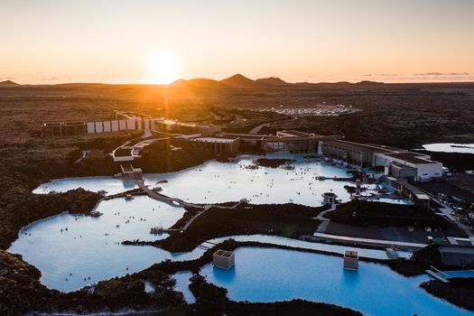
Blaa Lonid Thorbjorn
A hike that starts at the parking lot by the Blue Lagoon. The trail takes you pass beautiful blue mini lagoons and a moss covered lava field. Then you hike up Mount Þorbjörn where you’ll find a stunning rift in the mountain that is really fun to explore. Plus you get some great views over the surrounding area, including the Blue Lagoon itself. You can also skip climbing the mountain. Then it’s a much shorter and easier hike but still beautiful. The hike without the mountain climb is about 4 km/2.5 mi round trip. See more pictures and read more about this hike on my blog: https://siggadottir.com/the-perfect-blue-lagoon-combo/
 4.7 km
Eldvorp
Quite active geothermal area. Easy walk. But watch out in the lava. Some crevasses that are deep. Very beautiful area.
 5.4 km
Djupivogur Hafnarvegur
Walk along the sea and the straight back to the car. A 2 hour walk, there are no paths to follow. IF you click the header above you can see more pictures from the trip.
 9.8 km
Krísuvíkurbjarg
Krísuvíkurbjarg is a 9.8 km loop in the Reykjanes peninsula, recorded on the ground by a hiker — not traced off a map. Total ascent is modest at roughly 228 m.
 3.0 km
Berg - Helguvik
Berg - Helguvik is a 3.0 km loop in the Reykjanes peninsula, recorded on the ground by a hiker — not traced off a map.
 5.2 km
Krísuvíkurberg and 'Icelandic Gásaðalur'
Krísuvíkurberg and 'Icelandic Gásaðalur' runs about 5.2 km through the Reykjanes peninsula, mapped from an on-trail GPS track. It climbs about 270 m along the way — steady effort rather than a stroll.
 21 km
21 kmSeltún - Lambafellsgjá
Seltún - Lambafellsgjá runs about 21 km through the Reykjanes peninsula, mapped from an on-trail GPS track. Expect a proper climb: around 980 m of total ascent, so bring layers and give yourself daylight to spare.
 7.5 km
Geldingadalir-Suðurstrandavegur
Geldingadalir-Suðurstrandavegur is a 7.5 km route in the Reykjanes peninsula, recorded on the ground by a hiker — not traced off a map. Total ascent is modest at roughly 93 m.
 1.0 km
Seltun Krysuvik
Seltun Krysuvik runs about 1.0 km through the Reykjanes peninsula, mapped from an on-trail GPS track.
 20 km
20 kmReykjavegur-part1
Reykjavegur-part1 is a 20 km route in the Reykjanes peninsula, recorded on the ground by a hiker — not traced off a map. Total ascent is modest at roughly 162 m.
21 kmDalaleið
Dalaleið is a 21 km route in the Reykjanes peninsula, recorded on the ground by a hiker — not traced off a map. Expect a proper climb: around 633 m of total ascent, so bring layers and give yourself daylight to spare.
5.9 kmMeradalir eruption, new trail
A 5.9 km route in the Reykjanes peninsula, 13.08.2022 Meradalir eruption, new trail comes from a real GPS recording, so the line on the map is where feet actually went. Total ascent is modest at roughly 229 m.
 2.7 km
Iceland: Hafnarberg Sea Cliffs
Iceland: Hafnarberg Sea Cliffs runs about 2.7 km through the Reykjanes peninsula, mapped from an on-trail GPS track. Total ascent is modest at roughly 41 m.
 19 km
19 kmFagradalsfjall - Litli-Hrútur
A 19 km loop in the Reykjanes peninsula, Fagradalsfjall - Litli-Hrútur comes from a real GPS recording, so the line on the map is where feet actually went. Expect a proper climb: around 998 m of total ascent, so bring layers and give yourself daylight to spare.
 9.4 km
Almannaleið; Herdísarvík-Stóra Eldborg
A 9.4 km route in the Reykjanes peninsula, Almannaleið; Herdísarvík-Stóra Eldborg comes from a real GPS recording, so the line on the map is where feet actually went. Total ascent is modest at roughly 187 m.
4.5 kmSundhnúkur Crater and Lava Stream Hike
Sundhnúkur Crater and Lava Stream Hike is a 4.5 km route in the Reykjanes peninsula, recorded on the ground by a hiker — not traced off a map.
 1.4 km
blue lagoon
Blue lagoon runs about 1.4 km through the Reykjanes peninsula, mapped from an on-trail GPS track. Total ascent is modest at roughly 45 m.
3.3 kmTrack to volcano eruption site in Geldingadalir (East track)
Track to volcano eruption site in Geldingadalir (East track) runs about 3.3 km through the Reykjanes peninsula, mapped from an on-trail GPS track. It climbs about 253 m along the way — steady effort rather than a stroll.
 3.2 km
Þorbjörn in winter
Þorbjörn in winter is a 3.2 km loop in the Reykjanes peninsula, recorded on the ground by a hiker — not traced off a map. It climbs about 274 m along the way — steady effort rather than a stroll.
2.5 kmIceland active volcano B trail bc A was closed
A 2.5 km route in the Reykjanes peninsula, Iceland active volcano B trail bc A was closed comes from a real GPS recording, so the line on the map is where feet actually went. Total ascent is modest at roughly 191 m.
13 kmGrindavik
Grindavik is a 13 km route in the Reykjanes peninsula, recorded on the ground by a hiker — not traced off a map. It climbs about 534 m along the way — steady effort rather than a stroll.
 14 km
14 kmCliffs
Cliffs is a 14 km loop in the Reykjanes peninsula, recorded on the ground by a hiker — not traced off a map. Total ascent is modest at roughly 140 m.
4.8 kmTrack 007
Track 007 runs about 4.8 km through the Reykjanes peninsula, mapped from an on-trail GPS track. Total ascent is modest at roughly 146 m.
 23 km
23 kmSelvogur. Hamrarnir ofan Selvogs
A 23 km loop in the Reykjanes peninsula, Selvogur. Hamrarnir ofan Selvogs comes from a real GPS recording, so the line on the map is where feet actually went. It climbs about 456 m along the way — steady effort rather than a stroll.
 0.6 km
Blue L
Blue L runs about 0.6 km through the Reykjanes peninsula, mapped from an on-trail GPS track.
 10 km
10 kmGarður
A 10 km loop in the Reykjanes peninsula, Garður comes from a real GPS recording, so the line on the map is where feet actually went.
 3.0 km
Windy Sunday Walk
A 3.0 km loop in the Reykjanes peninsula, Windy Sunday Walk comes from a real GPS recording, so the line on the map is where feet actually went. Total ascent is modest at roughly 30 m.
 2.7 km
Gunnuhver
De Gunnuhver a Valahnukur - ISLANDIA runs about 2.7 km through the Reykjanes peninsula, mapped from an on-trail GPS track. Total ascent is modest at roughly 28 m.
 4.6 km
Garður, faro y playa
A 4.6 km loop in the Reykjanes peninsula, Garður, faro y playa comes from a real GPS recording, so the line on the map is where feet actually went.
 1.0 km
Acantilados de Valahnúkur
Acantilados de Valahnúkur is a 1.0 km loop in the Reykjanes peninsula, recorded on the ground by a hiker — not traced off a map. Total ascent is modest at roughly 48 m.
 0.6 km
Puente entre dos continentes
Puente entre dos continentes is a 0.6 km loop in the Reykjanes peninsula, recorded on the ground by a hiker — not traced off a map.
 0.6 km
Zona geotermal de Gunnuhver
Zona geotermal de Gunnuhver runs about 0.6 km through the Reykjanes peninsula, mapped from an on-trail GPS track.
 0.5 km
Acantilados de Krysuvíkurberg
Acantilados de Krysuvíkurberg runs about 0.5 km through the Reykjanes peninsula, mapped from an on-trail GPS track.
 6.6 km
Sýlingafell - Grindavík
Sýlingafell - Grindavík runs about 6.6 km through the Reykjanes peninsula, mapped from an on-trail GPS track. It climbs about 281 m along the way — steady effort rather than a stroll.
 5.3 km
Reykjanesbær - Njarðvík
Reykjanesbær - Njarðvík runs about 5.3 km through the Reykjanes peninsula, mapped from an on-trail GPS track. Total ascent is modest at roughly 23 m.
 1.2 km
Hafnir
A 1.2 km loop in the Reykjanes peninsula, Hafnir comes from a real GPS recording, so the line on the map is where feet actually went.
 4.1 km
Día 10: fumarolas
A 4.1 km loop in the Reykjanes peninsula, Día 10: fumarolas comes from a real GPS recording, so the line on the map is where feet actually went. Total ascent is modest at roughly 60 m.
 8.5 km
Njarðvík - Ytri-Njarðvík
Njarðvík - Ytri-Njarðvík is an 8.5 km route in the Reykjanes peninsula, recorded on the ground by a hiker — not traced off a map.
 20 km
20 kmGrindavik
Grindavik is a 20 km route in the Reykjanes peninsula, recorded on the ground by a hiker — not traced off a map. It climbs about 420 m along the way — steady effort rather than a stroll.
 8.2 km
Ketilstígur og Hattur
An 8.2 km loop in the Reykjanes peninsula, Ketilstígur og Hattur comes from a real GPS recording, so the line on the map is where feet actually went. Total ascent is modest at roughly 245 m.
 7.8 km
Keflavík not so City Walk
Keflavík not so City Walk runs about 7.8 km through the Reykjanes peninsula, mapped from an on-trail GPS track. Total ascent is modest at roughly 28 m.
 10 km
10 kmKeflavík City Walk
Keflavík City Walk is a 10 km route in the Reykjanes peninsula, recorded on the ground by a hiker — not traced off a map. Total ascent is modest at roughly 35 m.
 1.5 km
Stóra Eldborg
Stóra Eldborg is a 1.5 km loop in the Reykjanes peninsula, recorded on the ground by a hiker — not traced off a map. Total ascent is modest at roughly 68 m.
16 kmGeldingardalur
Geldingardalur is a 16 km loop in the Reykjanes peninsula, recorded on the ground by a hiker — not traced off a map. Expect a proper climb: around 672 m of total ascent, so bring layers and give yourself daylight to spare.
 5.0 km
Göngutúr um Sandgerði
Göngutúr um Sandgerði is a 5.0 km loop in the Reykjanes peninsula, recorded on the ground by a hiker — not traced off a map.
Cars & campers
 KEF airport pickup 24/74.8
 Transmission
 Fuel
Fuel Seats
Seats Drive
Drive

 Sleeps
Tours near Reykjanes Peninsula
 Small groups
 Duration
 Highlights
 Type
Type