Hansueli Krapf · Wikimedia Commons · CC BY-SA 3.0
 James St. John · Wikimedia Commons · CC BY 2.0
 Wikimedia Commons · CC BY 2.0
Reykjanes Peninsula Volcanoes

17 volcanoes in Reykjanes Peninsula — mapped with live road conditions, drive times, and directions.
17 volcanoes in Reykjanes Peninsula, led by Keilir and Geldingadalsgos 2021. All mapped with drive times, directions, and live road conditions.
Top volcanoes in Reykjanes Peninsula
The region's stand-outs — each with photos, facts, and its own page. Distances on the cards are straight-line from Reykjavík.
 378 m
378 mKeilir
Keilir is a Pleistocene subglacial mound or perhaps a conical tuya on Reykjanes Peninsula in Iceland. Basal area is 0.773 km2, summit area 0.004 km2, basal width 0.99 km, summit width 0.07 km, volume 0.0362 km3.
 Dormant
Geldingadalsgos 2021
2021 eruption at Fagradalsfjall near Reykjavík. First eruption in area for 800 years. Major tourist attraction. Lava field still visible.
 Active
Gossprunga við Litla-Hrút 2023
Fagradalsfjall is an active tuya volcano formed in the Last Glacial Period on the Reykjanes Peninsula, around 40 kilometres (25 mi) from Reykjavík, Iceland. Fagradalsfjall is also the name for the wider volcanic system covering an area 5 kilometres (3 mi) wide and 16 kilometres (10 mi) long between the Eldvörp–Svartsengi and Krýsuvík systems. The highest summit in this area is Langhóll. No volcanic eruption had occurred for 815 years on the Reykjanes Peninsula until 19 March 2021 when a fissure vent appeared in Geldingadalir to the south of Fagradalsfjall mountain. The 2021 eruption was effusi...
 Dormant
Þorbjörn
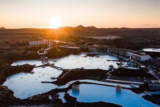
Þorbjörn is a 243 m high volcanic mountain next to the town of Grindavík (Gullbringusýsla) on Reykjanes peninsula, Iceland. Blue Lagoon can be easily seen from the summit.
 Dormant
Reykjanes (volcanic system)
Iceland (southwestern) / Crater rows / Eruption Observed
 385 m
385 mFagradalsfjall
The newcomer. Erupted in 2021 and 2022 after 800 years of silence. The hike to see fresh lava became Iceland's newest tourist attraction. May erupt again - check updates. Located on the Reykjanes peninsula, close to Reykjavík.
17 volcanoes in Reykjanes Peninsula
68 mSandfellshæð
Part of Iceland's volcanic backbone. The country has over 30 active volcanic systems. This one's contribution to the landscape is all around you.
ExtinctStampar Crater
Evidence of Iceland's fiery origins. Every landscape here was shaped by volcanoes, whether erupting today or millions of years ago.
378 mKeilir
Keilir is a Pleistocene subglacial mound or perhaps a conical tuya on Reykjanes Peninsula in Iceland. Basal area is 0.773 km2, summit area 0.004 km2, basal width 0.99 km, summit width 0.07 km, volume 0.0362 km3.
 91 m
91 mLágafell
Volcanic heritage site. Iceland is one of the most volcanically active places on Earth. Features like this are why.
Rauðhóll
Volcanic heritage site. Iceland is one of the most volcanically active places on Earth. Features like this are why.
 68 m
68 mSandfell
Volcanic heritage site. Iceland is one of the most volcanically active places on Earth. Features like this are why.
Miðahóll
Volcanic heritage site. Iceland is one of the most volcanically active places on Earth. Features like this are why.
DormantGeldingadalsgos 2021
2021 eruption at Fagradalsfjall near Reykjavík. First eruption in area for 800 years. Major tourist attraction. Lava field still visible.
ActiveGossprunga við Litla-Hrút 2023
Fagradalsfjall is an active tuya volcano formed in the Last Glacial Period on the Reykjanes Peninsula, around 40 kilometres (25 mi) from Reykjavík, Iceland. Fagradalsfjall is also the name for the wider volcanic system covering an area 5 kilometres (3 mi) wide and 16 kilometres (10 mi) long between the Eldvörp–Svartsengi and Krýsuvík systems. The highest summit in this area is Langhóll. No volcanic eruption had occurred for 815 years on the Reykjanes Peninsula until 19 March 2021 when a fissure vent appeared in Geldingadalir to the south of Fagradalsfjall mountain. The 2021 eruption was effusi...
Gos í Sundhnúksgígum 2023
2023 eruption in Sundhnúkur crater row, Reykjanes. Part of new volcanic activity cycle.
Gos við Grindavík
Recent volcanic activity near Grindavík town (2023-24). Part of ongoing Reykjanes eruption series. Town evacuated.
 DormantDormant
Þorbjörn
Þorbjörn is a 243 m high volcanic mountain next to the town of Grindavík (Gullbringusýsla) on Reykjanes peninsula, Iceland. Blue Lagoon can be easily seen from the summit.
DormantReykjanes (volcanic system)
Iceland (southwestern) / Crater rows / Eruption Observed
385 mFagradalsfjall
The newcomer. Erupted in 2021 and 2022 after 800 years of silence. The hike to see fresh lava became Iceland's newest tourist attraction. May erupt again - check updates. Located on the Reykjanes peninsula, close to Reykjavík.
 Dormant
Svartsengi
Eldvörp–Svartsengi ; "fire cones–black meadow" in Icelandic also Svartsengi volcanic system) is a volcanic system in the southwest of Iceland on the Southern Peninsula, southeast of Keflavík International Airport and north of the town of Grindavík. Made up of fissures, cones and volcanic craters, it had been relatively inactive for several centuries until 2020, when the first in a series of magmatic intrusions occurred. In December 2023 the fourth such intrusion culminated in an eruption, with further eruptions in 2024 and 2025.
Cars & campers
 KEF airport pickup 24/74.8
 Transmission
 Fuel
Fuel Seats
Seats Drive
Drive

 Sleeps
Tours near Reykjanes Peninsula
 Small groups
 Duration
 Highlights
 Type
Type