roquenval / Wikiloc
 Jakub_ / Wikiloc
 Harald Jóhannesson / Wikiloc
West Iceland Hikes

218 hikes in West Iceland — mapped with live road conditions, drive times, and directions.
218 hikes in West Iceland, led by Borgarnes Grimstadamuli and Brynjudasla Waterfall Hiking From Brynjudalsskogur 14 08 2021. All mapped with drive times, directions, and live road conditions.
Top hikes in West Iceland
The region's stand-outs — each with photos, facts, and its own page. Distances on the cards are straight-line from Reykjavík.
6.4 kmBorgarnes Grimstadamuli
Grimsstadir - Grímstaðamúli This walk in Grímstaðamúli mount is located 20 km north from Borgarnes. It boasts great views of the broad Borgarfjordur fjord and Hafnarfjall mountains. Rather easy stroll. It starts from the Grimsstadir farm. There is no marked trail with signs, but the way is up and easy to figure out until a pond, it makes a circle. The path does not lead to the summit of Grímstaðamúli but turns halfway to head its western slope called Mulaköst. The return goes through the descent of the small torrent Stekká (complicated in some places a bit steep, especially if it's wet, be careful).
6.4 kmBrynjudasla Waterfall Hiking From Brynjudalsskogur 14 08 2021
Very nice waterfall. 0 turists. Track to this place is almost invisible. Not many people going in this direction. Some trail was technically difficult, but if you are basically fit, you should do the trick.
7.4 kmHognhofdi 09 10 2010
Did this one with my brother in law, Hreiðar. Mt. Högnhöfði is close to mountain road F337 and only about 4km from Mt. Hlöðufell. We had very good weather calm, clear sky and about 10°C. View was outstanding and mountains and glaciers all around. Amongst other mountains one can see, Skriða, Skriðutinda, Rauðafell, Skjaldbreiður and on and on. The hike itself was quite easy, loose rocks in the beginning but there is kind of path there so if one follows that it´s easier. Great landscape where river Brúará has it´s origin can also been seen. To get there a four wheel drive is necessary and better to have a GPS since the landscape and lack of sign can easily get one lost.
 25 km
25 kmOk Volcano From Husafell Iceland 08 03 18
The Ok is a typical shield volcano with a very wide base compared to its height. This basically means that you have to walk a lot to get to the top, although the slopes are normally very gentle. The steepest part of this route is actually the first slope you see from the bottom of the Húsafell valley, in which you hike up one third of the route´s elevation gain in just 2 km. In this first part you can take any of the two paths on both sides of the small canyon (in winter is better to take the left one). From the top of that first slope the slopes are much less steep, so you need to walk another 10 km to hike up the other two thirds of the route´s elevation gain. The second part of the route is just a straight line up with only one remarkable point: a series of lagoons located around one kilometer after the top of the first slope (see waypoint on the map). On the summit of this volcano you will see the remains of a double crater. Locals like to go up to this mountain by 4x4 or ATV. The only things to be concerned with on this route are, first, that this mountain has generally bad weather conditions (very strong wind and fog are very common here), and second, there can be a lot of ice during the autumn, winter and spring. The Ok was considered as the smallest glacier in Iceland until few years ago. Now scientists have taken its glacier title because the ice cap on the top doesn’t meet the conditions for being considered as a glacier anymore, i.e., to move downwards by its own weight and that there is ice cap from winter to winter.
 7.4 km
Bjarnarhafnarfjall 24 04 2010
Fantastic trip, for the last km I was accompanied by a young eagle playing in the sky along with a falcon and few ravens. At the top two more eagles joined the party. In 2003 there were 57 pairs of eagles in Iceland so one could expect them to be maybe between 60-80 today. So three is a pretty big portion of the Icelandic Eagle population. They are mainly seen at the Breidafjordur Area, Gilsfjordur Area and in the West-Fjords
 12 km
12 kmHelgrindur 26 06 2010
Weather forecast was excellent, clear sky, calm and nice temperature, we got two out of three so the summit was cloudy. The track is defected since we had an accident on the way down and I stopped my Garmin and forgot to turn in on again until way down, but still usable.
218 hikes in West Iceland
6.4 kmBorgarnes Grimstadamuli
Grimsstadir - Grímstaðamúli This walk in Grímstaðamúli mount is located 20 km north from Borgarnes. It boasts great views of the broad Borgarfjordur fjord and Hafnarfjall mountains. Rather easy stroll. It starts from the Grimsstadir farm. There is no marked trail with signs, but the way is up and easy to figure out until a pond, it makes a circle. The path does not lead to the summit of Grímstaðamúli but turns halfway to head its western slope called Mulaköst. The return goes through the descent of the small torrent Stekká (complicated in some places a bit steep, especially if it's wet, be careful).
6.4 kmBrynjudasla Waterfall Hiking From Brynjudalsskogur 14 08 2021
Very nice waterfall. 0 turists. Track to this place is almost invisible. Not many people going in this direction. Some trail was technically difficult, but if you are basically fit, you should do the trick.
7.4 kmHognhofdi 09 10 2010
Did this one with my brother in law, Hreiðar. Mt. Högnhöfði is close to mountain road F337 and only about 4km from Mt. Hlöðufell. We had very good weather calm, clear sky and about 10°C. View was outstanding and mountains and glaciers all around. Amongst other mountains one can see, Skriða, Skriðutinda, Rauðafell, Skjaldbreiður and on and on. The hike itself was quite easy, loose rocks in the beginning but there is kind of path there so if one follows that it´s easier. Great landscape where river Brúará has it´s origin can also been seen. To get there a four wheel drive is necessary and better to have a GPS since the landscape and lack of sign can easily get one lost.
25 kmOk Volcano From Husafell Iceland 08 03 18
The Ok is a typical shield volcano with a very wide base compared to its height. This basically means that you have to walk a lot to get to the top, although the slopes are normally very gentle. The steepest part of this route is actually the first slope you see from the bottom of the Húsafell valley, in which you hike up one third of the route´s elevation gain in just 2 km. In this first part you can take any of the two paths on both sides of the small canyon (in winter is better to take the left one). From the top of that first slope the slopes are much less steep, so you need to walk another 10 km to hike up the other two thirds of the route´s elevation gain. The second part of the route is just a straight line up with only one remarkable point: a series of lagoons located around one kilometer after the top of the first slope (see waypoint on the map). On the summit of this volcano you will see the remains of a double crater. Locals like to go up to this mountain by 4x4 or ATV. The only things to be concerned with on this route are, first, that this mountain has generally bad weather conditions (very strong wind and fog are very common here), and second, there can be a lot of ice during the autumn, winter and spring. The Ok was considered as the smallest glacier in Iceland until few years ago. Now scientists have taken its glacier title because the ice cap on the top doesn’t meet the conditions for being considered as a glacier anymore, i.e., to move downwards by its own weight and that there is ice cap from winter to winter.
7.4 kmBjarnarhafnarfjall 24 04 2010
Fantastic trip, for the last km I was accompanied by a young eagle playing in the sky along with a falcon and few ravens. At the top two more eagles joined the party. In 2003 there were 57 pairs of eagles in Iceland so one could expect them to be maybe between 60-80 today. So three is a pretty big portion of the Icelandic Eagle population. They are mainly seen at the Breidafjordur Area, Gilsfjordur Area and in the West-Fjords
12 kmHelgrindur 26 06 2010
Weather forecast was excellent, clear sky, calm and nice temperature, we got two out of three so the summit was cloudy. The track is defected since we had an accident on the way down and I stopped my Garmin and forgot to turn in on again until way down, but still usable.
 7.8 km
Grundarfjordur
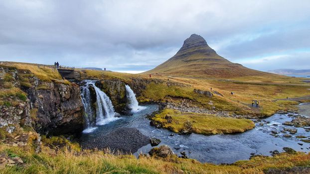
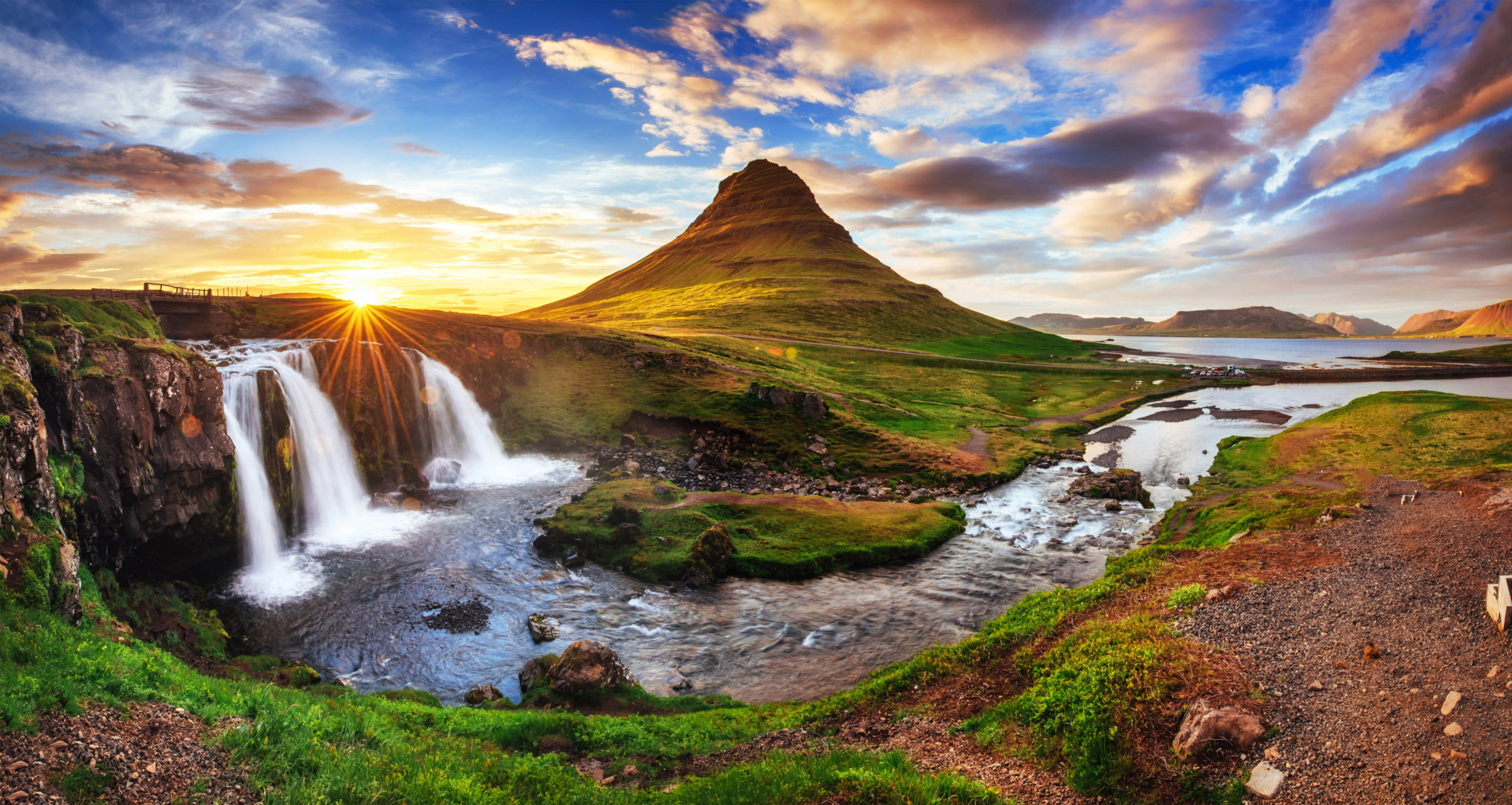
Hike from Grundarfjordur town to kirkujufellsfoss and then half-circle Kirkjufell mountain. Picked up by Zodiac from ship :)
 10 km
10 kmHroarstindar 30 Jan 2010 09 09
Hiking around 6,5 hours from the parking though Hafnardal behind Hafnarfjall to Hróarstindar 792m. -14°at the top in little wind but clear sky. Had to fix the track at the top (out of battery, but should be useble)
 6.9 km
Karaborg
 16 km
16 kmHrafnabjorg Thingvellir
Easy but a bit long hike to hrafnabjorg at iceland national park thingvellir. great view to all directions.
 6.3 km
Selgil Husafell
Selgil - Húsafell. Very nice trail. In winter some ice and snow, crampons required. We came the same way back as the river was too treacherous to cross. Beautiful waterfall.
 8.6 km
Kvigindisfell 29 05 2010
Decided to do this one as well on my way back home after doing Fanntófell and Litla Björnsfell. The sky had cleared a bit so there was a good view to Mt. Hvalfell, Botnssúlur, OK, Skjaldbreiður and other mountains, really worth ending the trip on this one.
 7.1 km
Budakirkja Budarklettur Budahellir
Wonderful walk from the beach over species-rich green lavafield on top of the ridge of the volcano crater Búðarklettur and to a small walk-on-able cave (about 50 m deep). Nearly same way back to the chirch.
 7.9 km
Borgarvirki Hringur
Starts from Borgarvirki, then goes alongside the lake, through fields and back on the trail. Then visit of Borgarvirki with the sun dial and beautiful views of Húnaflói.
 5.9 km
Drapuhlidarfjall 08 05 2010
This interesting Mountain is in Snæfellsnes peninsula. It´s mainly liparite, but also there´s a lot af all kinds of valuable metals including gold, but not favorable to process. Part of the mountain is called Gullberg (e. Goldrock)
 8.6 km
Brattabrekka
I had always been puzzled as to why this mountain pass was referred to as "Brattabrekka" ("Steep Slope") as it didn't feature any unusual gradients. It wasn't until last summer that I discovered that the roadway had actually been moved between valleys and away from the "steep slope" while retaining the name. Ever since I have wanted to hike the old road (disused for at least 30 years, possibly longer) - today I did it! I must admit that along some stretches I probably didn't follow the original roadway, it has completely disappeared. Still, where the topography required cuts to be made you can still make them out - and those are of course the interesting bits. A pleasant two hour walk.
 17 km
17 kmAround Hitarvatn Day 2 3
Around Hítarvatn day 2/3. Idea to go from tjaldbrekka vid Hítarvatn to Tröllakirkja, along Smjörhnúkur and connect down at Vatnaleið (Skálaleið). Was not sure which way to go on top of Smjörhnúkur so just came down after summiting Tröllakirkja. Was alone so did not take any risks on a windy day... Unmarked trail, but easy to navigate in good weather. Terrain is pretty rough and the climb to Trællakirkja from the tjaldbrekka has quite a bit loose rocks. You might need to check if there´s a safer way up. I followed a wikiloc trail but the tjaldleið map shows to approach the summit from the left side, not straight on from the valley.
 8.0 km
Hrutaborg 26 06 2010
This one was kind of surprise, very easy first 3km then got steeper and almost vertical cliffs at the end. First we tried to go up them at the wrong place so beware if you download the track. Almost got ourselves stuck but managed to get down and up at the right spot which was easy. Foggy on the top but mystic. When we got down it had cleared. Really recommend this one, but be careful
 11 km
11 kmAround Hitarvatn Day 3
Around Hítarvatn day 3/3. From Hólmur skull back to the start point at Hlíðarvatn. Easiest stretch on the hike, marked most of the way, although I lost the markings a couple of times.
 7.8 km
Hellissandur
I wouldn't say that it's an hard walk, but there's no a real trail to go up and it's very muddy and slippery over there and it's not nice to walk. The view of the glacier on the back it's amazing. With cramps it's far better if you wanna keep going up to thetop
 3.1 km
Medalfell Hiking Medalfell Hiking 14 08 2021
Amazing view from the top. This area is beautiful, picturesque and varied. In one place we have mountains, rivers ,valleys, lake, waterfalls and Hvalfjörður bigest fjord in area. With a little effort you can see it all in one place
 16 km
16 kmAround Hitarvatn Day 1 3
Aound Hítarvatn day 1. Made a three-day loop, following tjaldleið on the northern side of Hítavatn and connecting to skálaleið on the southern side of Hítavratn. This section (from Hliðarvatn to Hítarvatn is unmarked. Followed a wikiloc trail but got often carried away by sheep trails. I would not exactly follow this trail as it zigzags through but it+s an idea if you want to do a loop instead of the full Vatnaleið.
 6.5 km
Laugarvatn Round Path
Laugarvatn round path! We invented they way down is not that easy path but for sure was a good round way! Totally recommend to follow!
 9.5 km
Hvanneyri Glymur
Really great hike. steep and a log river crossing IN The BEGINNING- and a real to your knees river crossing at the top of the hike. Chose to Carry our 10 year old across the top crossing (nor an option at the bottom- the 12 year old walking in mother's sandals in the cold water. Make sure to cross the river at the log and make your climb on the far side of the river from the parking lot. And our advice is that you just follow the route down we did not. We went down following a +/- track close the the river and canyon but the views were not great going down and the track not great either
 13 km
13 kmLitla Bjornsfell 29 05 2010
Kind of long walk towards the mountain itself and then sudden ascent. I would recommend if one plans to do "Stóra Björnsfell" it´s best to do both at same go, unless the weather is like to day (cloudy) I was very interested when I saw in "The book" (Icelandic Mountains, hiking trails to 151 Mt) that a mountain next to Litla Björnsfell is named Haraldstindur (Haralds-peak), but in fact it just looks like a pile of mud ;) pretty high pile though.
 12 km
12 kmMoskardshnjukar Medafellsvatn Day 2 Of 2
Chill start along the river, then turned off the path up to the ridge. No tracks pretty much until the descent from Moskarðshnjukar. A mix of moss, grass, stones and gravel made it heavy work. Once on the ridge, I turn Southwards again and head over the progressively bigger summits. The ridge leading to Trana is fun (see pics). The final climb up the North-East side of Moskarðshnjukar is very hard work. Not particularly difficult or dangerous, but the ground (piles of shale scree) gives way with every step. This is compounded by the overnight bag, headwind and occasional showers. There are some hints of a path but the route is mostly on instinct. Finally arrive at the summit with great views and the drop down to the river. Tough hike, but good training :) (Would be a lot more enjoyable in the opposite direction) (P.s. getting sick on day 1 made todays tricky hike more draining)
 14 km
14 kmSydstasula Haasula Hvalvatn Day 2 Of 2
Today's gradient is a lot easier but the conditions way tougher. Failing to get back to sleep I decide to get up at 5, and start hiking at 06:30. I make my way through an open riverbed heading Southwest beneath Vestursúla. I then cut the corner accross to the main Southbound track. The combination of warmth, no wind, deep moss and manic flies makes for a maddening 45min. Finally round the corner the terrain becomes easier, descending but now into a heavy crosswind. The km tick by and the rain increases. The final 2h are filled mostly with heavy downpours head on. Not my finest hour, literally, I really want a break. Finally the clouds lift slightly as the with views of þingvellirvatn at the finishing line. A great 2-day hike, and what a mountain range! Looking forward to visiting Botnssnúlur again soon.
 21 km
21 kmLaugarvatn Bruarfoss Uthlid
Easy hike. Most of the time the gps was needed because there was no visible trail, it passes by the amazing and beautiful Bruarfoss. There was 1 river I had to pass walking into the near -to-frozen water. The end of this hike is a camping site with hot tubs.
 9.3 km
Hadegisfell
It’s a relatively easy hike with a river crossing at the beginning and some steeper parts but easily manageable.
 4.3 km
Bruarfoss
Brúarfoss, nice stroll. You can leave your car even further, until the end of the road, approximately 500 mt further than my start point. The path is sometimes a bit difficult to follow just because there are a lot of small paths and it's difficult to choose what is the right one, but no fear! Almost all paths lead to the waterfall. Be aware that it can be very muddy when it rains.
 18 km
18 kmKlofningsfjall 19 04 2011
Clear weather and on paper very easy mountain, however, snow was deep which made it moderate and good training. Nice view to many of the islands in Breiðafjörður, but once you get up it´s just a plateau which looks more like snow desert this time of year and not very interesting for hiking/mountainering.
 3.7 km
Tour Around Stykkisholmur
The beautiful village of Stykkishólmur is often an overnight stop for tourists, but it is also worth taking a look at the village itself. Armed with a map from Wikiloc, I looked up the attractions of the village and improvised this route myself. The eye-catcher is of course the lighthouse that stands on a small hill overlooking the village. It also gives a nice view over the small harbor where the ferry is situated that sails to the Westfjords. The modern church is also worth a stop as this is one of the more daring churches in Iceland in terms of design. In the village center there are some historic houses such as the Norwegian House and Volcano Museum. At the Library of Water a climb brings you up to a top where you have a nice view over the village and the church. Stykkishólmur is also a great place to do street photography.
 6.2 km
Snokur 12 Jan 2010 18 12
Hiked from the farmtow Neða skarð following good path "Skarðsheiði"(possible to drive some part) upp most of the altitude.
 2.5 km
Klakkshaus
This is a fantastic hike from the road access near the coast up the back side of a small mountain onto the plateau top. Pleasant easy start, well marked with small posts, becomes difficult near the top with very steep sections and loose rock and gravel. Once onto the plateau you can can easily walk around to all sides. There are beautiful scenic views of both sides of the peninsula, including Kirkjufell and Grundarfjörður to the southwest. We were tourists and I recall we found this trail on a map at the visitor centre in Grundarfjörður. Great full day hike.
 5.2 km
Presthnukur Vid Geitlandsjokul
We went about 27 people from "Fjallafélagið" hiking group and summited Prestahnúk west of Langjökull in Iceland 8. june 2025. There was a lot of new snow from a week before and that made a few obstacles on the road leading up to the starting point. So we had only 4x4 with altered tires and suspension. But in normal conditions, a 4x4 jeep is necessary to go there. The hike itself is rather steep and crampons and iceaxe were necessary.
 7.6 km
Snaefellsnes : Hellnar - Arnarstapi
A 7.6 km loop in West Iceland, Snaefellsnes : Hellnar - Arnarstapi comes from a real GPS recording, so the line on the map is where feet actually went. Total ascent is modest at roughly 145 m.
 9.0 km
Berserkjahraun, Snaefellsnes peninsula
Berserkjahraun, Snaefellsnes peninsula is a 9.0 km loop in West Iceland, recorded on the ground by a hiker — not traced off a map. It climbs about 314 m along the way — steady effort rather than a stroll.
 4.8 km
Hestfjall Borg.
Hestfjall Borg. 08.05.2010 runs about 4.8 km through West Iceland, mapped from an on-trail GPS track. It climbs about 263 m along the way — steady effort rather than a stroll.
 6.6 km
Geitland
Geitland runs about 6.6 km through West Iceland, mapped from an on-trail GPS track. Total ascent is modest at roughly 95 m.
 7.9 km
Thverlfell
A 7.9 km loop in West Iceland, Thverlfell 30.05.2020 comes from a real GPS recording, so the line on the map is where feet actually went. It climbs about 561 m along the way — steady effort rather than a stroll.
 4.5 km
Selvellir and Selvalafoss
A 4.5 km loop in West Iceland, Selvellir and Selvalafoss comes from a real GPS recording, so the line on the map is where feet actually went. It climbs about 306 m along the way — steady effort rather than a stroll.
 12 km
12 kmStapafell, Stakfell and Kvíahnúkur
Stapafell, Stakfell and Kvíahnúkur 29.05.2022 runs about 12 km through West Iceland, mapped from an on-trail GPS track. Expect a proper climb: around 803 m of total ascent, so bring layers and give yourself daylight to spare.
 5.6 km
Iceland: Around Malarri
Iceland: Around Malarri is a 5.6 km route in West Iceland, recorded on the ground by a hiker — not traced off a map. Total ascent is modest at roughly 54 m.
 6.3 km
Hike to a dead end
Hike to a dead end runs about 6.3 km through West Iceland, mapped from an on-trail GPS track. Expect a proper climb: around 925 m of total ascent, so bring layers and give yourself daylight to spare.
 4.7 km
Snaefellsjokull
A 4.7 km route in West Iceland, Snaefellsjokull comes from a real GPS recording, so the line on the map is where feet actually went. Expect a proper climb: around 783 m of total ascent, so bring layers and give yourself daylight to spare.
 5.8 km
Gullbogarhellar cratera
A 5.8 km loop in West Iceland, Gullbogarhellar cratera comes from a real GPS recording, so the line on the map is where feet actually went. Total ascent is modest at roughly 136 m.
 5.6 km
Grimsfjall
Grimsfjall is a 5.6 km route in West Iceland, recorded on the ground by a hiker — not traced off a map. It climbs about 469 m along the way — steady effort rather than a stroll.
 12 km
12 kmStorm orka
Storm orka is a 12 km loop in West Iceland, recorded on the ground by a hiker — not traced off a map. It climbs about 389 m along the way — steady effort rather than a stroll.
 15 km
15 kmLjósufjöll
A 15 km route in West Iceland, Ljósufjöll comes from a real GPS recording, so the line on the map is where feet actually went. Expect a proper climb: around 989 m of total ascent, so bring layers and give yourself daylight to spare.
 6.7 km
Bláskógabyggð
Bláskógabyggð is a 6.7 km loop in West Iceland, recorded on the ground by a hiker — not traced off a map. It climbs about 542 m along the way — steady effort rather than a stroll.
 20 km
20 kmLeggjabrjótur
Leggjabrjótur runs about 20 km through West Iceland, mapped from an on-trail GPS track. Expect a proper climb: around 732 m of total ascent, so bring layers and give yourself daylight to spare.
 3.4 km
Hellnar - Arnarstapi by siggadottir
A 3.4 km route in West Iceland, Hellnar - Arnarstapi by siggadottir comes from a real GPS recording, so the line on the map is where feet actually went. Total ascent is modest at roughly 36 m.
 8.9 km
Hafnarfjall Borgarfjörður Iceland
Hafnarfjall Borgarfjörður Iceland runs about 8.9 km through West Iceland, mapped from an on-trail GPS track. Expect a proper climb: around 1216 m of total ascent, so bring layers and give yourself daylight to spare.
 5.8 km
Akrar
Akrar runs about 5.8 km through West Iceland, mapped from an on-trail GPS track.
 6.5 km
Snæfellsjökull
A 6.5 km route in West Iceland, Snæfellsjökull comes from a real GPS recording, so the line on the map is where feet actually went. Expect a proper climb: around 741 m of total ascent, so bring layers and give yourself daylight to spare.
 0.7 km
Murals of Hellissandur
A 0.7 km loop in West Iceland, Murals of Hellissandur comes from a real GPS recording, so the line on the map is where feet actually went.
 12 km
12 kmGrímsstaðamúli
A 12 km loop in West Iceland, Grímsstaðamúli 11.04.2010 comes from a real GPS recording, so the line on the map is where feet actually went. It climbs about 495 m along the way — steady effort rather than a stroll.
 32 km
32 kmÓlafsvik - Djúpalónssandur
Ólafsvik - Djúpalónssandur is a 32 km route in West Iceland, recorded on the ground by a hiker — not traced off a map. Expect a proper climb: around 786 m of total ascent, so bring layers and give yourself daylight to spare.
 6.0 km
Grundarfjörður short loop
A 6.0 km loop in West Iceland, Grundarfjörður short loop comes from a real GPS recording, so the line on the map is where feet actually went. Total ascent is modest at roughly 217 m.
 0.9 km
Djúpalónssandur Beach
Djúpalónssandur Beach is a 0.9 km loop in West Iceland, recorded on the ground by a hiker — not traced off a map. Total ascent is modest at roughly 99 m.
 15 km
15 kmHestur frá Rauðamelsölkeldu
Hestur frá Rauðamelsölkeldu runs about 15 km through West Iceland, mapped from an on-trail GPS track. Expect a proper climb: around 927 m of total ascent, so bring layers and give yourself daylight to spare.
 16 km
16 kmHáihnúkur and Geirmundartindur from Akranes
A 16 km loop in West Iceland, Háihnúkur and Geirmundartindur from Akranes comes from a real GPS recording, so the line on the map is where feet actually went. Expect a proper climb: around 1290 m of total ascent, so bring layers and give yourself daylight to spare.
 15 km
15 kmHitarvatn loop
Hitarvatn loop is a 15 km loop in West Iceland, recorded on the ground by a hiker — not traced off a map. Expect a proper climb: around 603 m of total ascent, so bring layers and give yourself daylight to spare.
 17 km
17 kmSkriða
A 17 km loop in West Iceland, Skriða comes from a real GPS recording, so the line on the map is where feet actually went. Expect a proper climb: around 812 m of total ascent, so bring layers and give yourself daylight to spare.
 2.4 km
Búðir - three summits
A 2.4 km loop in West Iceland, Búðir - three summits comes from a real GPS recording, so the line on the map is where feet actually went. Total ascent is modest at roughly 229 m.
 1.4 km
Elf stone
The Elf stone runs about 1.4 km through West Iceland, mapped from an on-trail GPS track. It climbs about 322 m along the way — steady effort rather than a stroll.
 10 km
10 kmHellissandur in July
Hellissandur in July runs about 10 km through West Iceland, mapped from an on-trail GPS track. Total ascent is modest at roughly 72 m.
 8.1 km
Hrístindahnúkur peak
Hrístindahnúkur peak is an 8.1 km loop in West Iceland, recorded on the ground by a hiker — not traced off a map. Expect a proper climb: around 735 m of total ascent, so bring layers and give yourself daylight to spare.
 11 km
11 kmSkriðutindar
Skriðutindar is an 11 km loop in West Iceland, recorded on the ground by a hiker — not traced off a map. It climbs about 592 m along the way — steady effort rather than a stroll.
 20 km
20 kmSkyrtunna-Across Snafelssnes peninsula
Skyrtunna-Across Snafelssnes peninsula runs about 20 km through West Iceland, mapped from an on-trail GPS track. Expect a proper climb: around 1037 m of total ascent, so bring layers and give yourself daylight to spare.
 10 km
10 kmLitla Björnsfell
Litla Björnsfell is a 10 km loop in West Iceland, recorded on the ground by a hiker — not traced off a map. It climbs about 542 m along the way — steady effort rather than a stroll.
 17 km
17 kmLitla Baula, Mælifell and Baula
Litla Baula, Mælifell and Baula 22.07.2022 is a 17 km loop in West Iceland, recorded on the ground by a hiker — not traced off a map. Expect a proper climb: around 1196 m of total ascent, so bring layers and give yourself daylight to spare.
 12 km
12 kmAustur Helgrindur
Austur Helgrindur 04.09.2022 is a 12 km loop in West Iceland, recorded on the ground by a hiker — not traced off a map. Expect a proper climb: around 934 m of total ascent, so bring layers and give yourself daylight to spare.
 5.5 km
Kálfatindar near Laugarvatn and Laugarvatnshellir cave
Kálfatindar near Laugarvatn and Laugarvatnshellir cave is a 5.5 km loop in West Iceland, recorded on the ground by a hiker — not traced off a map. It climbs about 432 m along the way — steady effort rather than a stroll.
 27 km
27 kmEiríksjökull - AUG.2020
Eiríksjökull - AUG.2020 runs about 27 km through West Iceland, mapped from an on-trail GPS track. Expect a proper climb: around 1902 m of total ascent, so bring layers and give yourself daylight to spare.
 2.5 km
Nyjabud
Nyjabud runs about 2.5 km through West Iceland, mapped from an on-trail GPS track.
 6.4 km
Failfoss - DO NOT FOLLOW
Failfoss - DO NOT FOLLOW is a 6.4 km loop in West Iceland, recorded on the ground by a hiker — not traced off a map. It climbs about 352 m along the way — steady effort rather than a stroll.
 5.3 km
Waterfall
Waterfall is a 5.3 km loop in West Iceland, recorded on the ground by a hiker — not traced off a map. Total ascent is modest at roughly 142 m.
5.7 kmÖlver og Blakollur
A 5.7 km loop in West Iceland, Ölver og Blakollur comes from a real GPS recording, so the line on the map is where feet actually went. Expect a proper climb: around 657 m of total ascent, so bring layers and give yourself daylight to spare.
 16 km
16 kmKistufell og Skerðingsstaðafjall
A 16 km loop in West Iceland, Kistufell og Skerðingsstaðafjall 11.02.2022 comes from a real GPS recording, so the line on the map is where feet actually went. Expect a proper climb: around 1137 m of total ascent, so bring layers and give yourself daylight to spare.
 18 km
18 kmGeology fun
Geology fun runs about 18 km through West Iceland, mapped from an on-trail GPS track. It climbs about 436 m along the way — steady effort rather than a stroll.
 0.6 km
Base Camp Brynjudalur
Base Camp Brynjudalur runs about 0.6 km through West Iceland, mapped from an on-trail GPS track.
 10 km
10 kmSnaefellsjökull
Snaefellsjökull runs about 10 km through West Iceland, mapped from an on-trail GPS track. Expect a proper climb: around 827 m of total ascent, so bring layers and give yourself daylight to spare.
 1.4 km
Budir
Budir runs about 1.4 km through West Iceland, mapped from an on-trail GPS track.
 2.9 km
Snaefellsnes - Budahraun
Snaefellsnes - Budahraun is a 2.9 km route in West Iceland, recorded on the ground by a hiker — not traced off a map.
11 kmSneffels
An 11 km loop in West Iceland, Sneffels comes from a real GPS recording, so the line on the map is where feet actually went. Expect a proper climb: around 828 m of total ascent, so bring layers and give yourself daylight to spare.
 11 km
11 kmIsland
An 11 km route in West Iceland, Island comes from a real GPS recording, so the line on the map is where feet actually went. Expect a proper climb: around 748 m of total ascent, so bring layers and give yourself daylight to spare.
 3.6 km
Kerlingarfjall
Kerlingarfjall is a 3.6 km loop in West Iceland, recorded on the ground by a hiker — not traced off a map. It climbs about 312 m along the way — steady effort rather than a stroll.
2.3 kmAnn Turner
Ann Turner is a 2.3 km route in West Iceland, recorded on the ground by a hiker — not traced off a map. It climbs about 336 m along the way — steady effort rather than a stroll.
 0.7 km
Eb dating
Eb dating runs about 0.7 km through West Iceland, mapped from an on-trail GPS track. Total ascent is modest at roughly 60 m.
 3.2 km
Eldborg West Iceland
Eldborg West Iceland is a 3.2 km route in West Iceland, recorded on the ground by a hiker — not traced off a map. Total ascent is modest at roughly 95 m.
 12 km
12 kmGlymur + Breiðifoss + Hvalvatn
Glymur + Breiðifoss + Hvalvatn is a 12 km loop in West Iceland, recorded on the ground by a hiker — not traced off a map. Expect a proper climb: around 743 m of total ascent, so bring layers and give yourself daylight to spare.
 8.7 km
Hafursfell á Snæfellsnesi, toppar 2og3
Hafursfell á Snæfellsnesi, toppar 2og3 runs about 8.7 km through West Iceland, mapped from an on-trail GPS track. Expect a proper climb: around 744 m of total ascent, so bring layers and give yourself daylight to spare.
 12 km
12 kmLýsuhyrna, Smjörhnjúkur og Ánahyrna á Snæfellsnesi
 6.9 km
Soft Hiking
Soft Hiking runs about 6.9 km through West Iceland, mapped from an on-trail GPS track. It climbs about 342 m along the way — steady effort rather than a stroll.
 8.9 km
cascade
An 8.9 km loop in West Iceland, cascade comes from a real GPS recording, so the line on the map is where feet actually went. It climbs about 272 m along the way — steady effort rather than a stroll.
 16 km
16 kmPílagrímaganga um Síldarmannagötur 24/6 2018
Pílagrímaganga um Síldarmannagötur 24/6 2018 is a 16 km route in West Iceland, recorded on the ground by a hiker — not traced off a map. It climbs about 500 m along the way — steady effort rather than a stroll.
 13 km
13 kmRauðakúla og Hreggnasi á Snæfellsnesi
 7.5 km
Hafursfell á Snæfellsnesi, toppur 1
A 7.5 km loop in West Iceland, Hafursfell á Snæfellsnesi, toppur 1 comes from a real GPS recording, so the line on the map is where feet actually went. Expect a proper climb: around 743 m of total ascent, so bring layers and give yourself daylight to spare.
 6.5 km
Hreggnasi from Hellissandur
A 6.5 km loop in West Iceland, Hreggnasi from Hellissandur comes from a real GPS recording, so the line on the map is where feet actually went. It climbs about 385 m along the way — steady effort rather than a stroll.
14 kmAustur Helgrindur
A 14 km loop in West Iceland, Austur Helgrindur 18.09.2022 comes from a real GPS recording, so the line on the map is where feet actually went. Expect a proper climb: around 951 m of total ascent, so bring layers and give yourself daylight to spare.
 8.6 km
Búrfell Hálsasveit
An 8.6 km loop in West Iceland, Búrfell Hálsasveit 27.02.2022 comes from a real GPS recording, so the line on the map is where feet actually went. It climbs about 402 m along the way — steady effort rather than a stroll.
 16 km
16 kmStóri-Reyðarbarmur og Kálfstindar
A 16 km loop in West Iceland, Stóri-Reyðarbarmur og Kálfstindar comes from a real GPS recording, so the line on the map is where feet actually went. Expect a proper climb: around 1084 m of total ascent, so bring layers and give yourself daylight to spare.
 14 km
14 kmElliðatindar
Elliðatindar runs about 14 km through West Iceland, mapped from an on-trail GPS track. Expect a proper climb: around 1371 m of total ascent, so bring layers and give yourself daylight to spare.
 1.3 km
Hellissandur
Hellissandur is a 1.3 km route in West Iceland, recorded on the ground by a hiker — not traced off a map.
 13 km
13 kmSkarðshyrna og Heiðarhorn 8. júlí 2019
A 13 km loop in West Iceland, Skarðshyrna og Heiðarhorn 8. júlí 2019 comes from a real GPS recording, so the line on the map is where feet actually went. Expect a proper climb: around 1119 m of total ascent, so bring layers and give yourself daylight to spare.
 12 km
12 kmHólsfjall og Tröllatindar á Snæfellsnesi
 11 km
11 kmSeljafell 580m á Snæfellsnesi
Seljafell 580m á Snæfellsnesi runs about 11 km through West Iceland, mapped from an on-trail GPS track. It climbs about 478 m along the way — steady effort rather than a stroll.
 9.1 km
Grímsfjall og Kerlingarfjall á Snæfellsnesi
A 9.1 km loop in West Iceland, Grímsfjall og Kerlingarfjall á Snæfellsnesi comes from a real GPS recording, so the line on the map is where feet actually went. Expect a proper climb: around 806 m of total ascent, so bring layers and give yourself daylight to spare.
 15 km
15 kmBotna-Skyrtunna úr Álftafirði Snæf
Botna-Skyrtunna úr Álftafirði Snæf. runs about 15 km through West Iceland, mapped from an on-trail GPS track. Expect a proper climb: around 998 m of total ascent, so bring layers and give yourself daylight to spare.
 15 km
15 kmTindfell, Hrói, Rjúpnaborgir og Enni fyrir ofan Ólafsvík Snæf
A 15 km loop in West Iceland, Tindfell, Hrói, Rjúpnaborgir og Enni fyrir ofan Ólafsvík Snæf. comes from a real GPS recording, so the line on the map is where feet actually went. Expect a proper climb: around 957 m of total ascent, so bring layers and give yourself daylight to spare.
 9.2 km
Lang
A 9.2 km route in West Iceland, Lang comes from a real GPS recording, so the line on the map is where feet actually went. It climbs about 429 m along the way — steady effort rather than a stroll.
11 kmAfternoon Backcountry Ski
Afternoon Backcountry Ski runs about 11 km through West Iceland, mapped from an on-trail GPS track. Expect a proper climb: around 1118 m of total ascent, so bring layers and give yourself daylight to spare.
 9.1 km
Truffula Trail
Truffula Trail is a 9.1 km loop in West Iceland, recorded on the ground by a hiker — not traced off a map. It climbs about 302 m along the way — steady effort rather than a stroll.
 55 km
55 kmBull
A 55 km route in West Iceland, Bull comes from a real GPS recording, so the line on the map is where feet actually went. It climbs about 581 m along the way — steady effort rather than a stroll.
5.8 kmHellnar
A 5.8 km loop in West Iceland, Hellnar comes from a real GPS recording, so the line on the map is where feet actually went. Total ascent is modest at roughly 36 m.
 7.2 km
Up the hill
A 7.2 km loop in West Iceland, Up the hill comes from a real GPS recording, so the line on the map is where feet actually went. It climbs about 389 m along the way — steady effort rather than a stroll.
 5.6 km
Beach
Beach runs about 5.6 km through West Iceland, mapped from an on-trail GPS track. Total ascent is modest at roughly 33 m.
8.5 kmSnaefell
Snaefell runs about 8.5 km through West Iceland, mapped from an on-trail GPS track. Expect a proper climb: around 764 m of total ascent, so bring layers and give yourself daylight to spare.
 3.4 km
Dritvík
A 3.4 km loop in West Iceland, Playas de Djúpalónssandur y Dritvík. Snaefellsness. Islandia comes from a real GPS recording, so the line on the map is where feet actually went. Total ascent is modest at roughly 73 m.
 16 km
16 kmSkarðsheiði - 5 tindar
A 16 km route in West Iceland, Skarðsheiði - 5 tindar comes from a real GPS recording, so the line on the map is where feet actually went. Expect a proper climb: around 1202 m of total ascent, so bring layers and give yourself daylight to spare.
 13 km
13 kmBrúarárskörð og Högnhöfði
 4.7 km
laugarvatns fjall
Laugarvatns fjall is a 4.7 km loop in West Iceland, recorded on the ground by a hiker — not traced off a map. It climbs about 427 m along the way — steady effort rather than a stroll.
 16 km
16 kmLjósufjöll á Snæfellsnesi
 6.2 km
Grundarfjörður- Kirkjufell Mountain summer hike
A 6.2 km route in West Iceland, Grundarfjörður- Kirkjufell Mountain summer hike comes from a real GPS recording, so the line on the map is where feet actually went. It climbs about 312 m along the way — steady effort rather than a stroll.
 11 km
11 kmSkarðsheiði
Skarðsheiði runs about 11 km through West Iceland, mapped from an on-trail GPS track. Expect a proper climb: around 822 m of total ascent, so bring layers and give yourself daylight to spare.
 3.0 km
Selárgil
Selárgil is a 3.0 km loop in West Iceland, recorded on the ground by a hiker — not traced off a map. Total ascent is modest at roughly 70 m.
 4.5 km
Hvalfjarðareyri
Hvalfjarðareyri is a 4.5 km loop in West Iceland, recorded on the ground by a hiker — not traced off a map.
 0.7 km
Grábrók crater rim to road
Grábrók crater rim to road runs about 0.7 km through West Iceland, mapped from an on-trail GPS track.
 2.4 km
Rauðisandur
Rauðisandur runs about 2.4 km through West Iceland, mapped from an on-trail GPS track.
 0.7 km
Lóndrangar Viewpoint
Lóndrangar Viewpoint runs about 0.7 km through West Iceland, mapped from an on-trail GPS track. Total ascent is modest at roughly 32 m.
 1.0 km
Hofsstadaskogur
A 1.0 km loop in West Iceland, Hofsstadaskogur comes from a real GPS recording, so the line on the map is where feet actually went. Total ascent is modest at roughly 50 m.
1.9 kmRauðfeldsgjá
A 1.9 km loop in West Iceland, Rauðfeldsgjá comes from a real GPS recording, so the line on the map is where feet actually went. It climbs about 288 m along the way — steady effort rather than a stroll.
 0.3 km
Sjávarfoss
Sjávarfoss is a 0.3 km loop in West Iceland, recorded on the ground by a hiker — not traced off a map.
 0.6 km
Klofningur í Dölum
A 0.6 km loop in West Iceland, Klofningur í Dölum comes from a real GPS recording, so the line on the map is where feet actually went. Total ascent is modest at roughly 31 m.
 0.8 km
Borgarvirki
A 0.8 km loop in West Iceland, Borgarvirki comes from a real GPS recording, so the line on the map is where feet actually went. Total ascent is modest at roughly 23 m.
 2.5 km
Kolugljúfur í Víðidal
A 2.5 km loop in West Iceland, Kolugljúfur í Víðidal. comes from a real GPS recording, so the line on the map is where feet actually went. Total ascent is modest at roughly 83 m.
 6.2 km
Gamli þjóðvegurinn yfir Hrútafjarðarháls frá Reykjum að Sveðjustöðum
Gamli þjóðvegurinn yfir Hrútafjarðarháls frá Reykjum að Sveðjustöðum. runs about 6.2 km through West Iceland, mapped from an on-trail GPS track. It climbs about 369 m along the way — steady effort rather than a stroll.
 3.3 km
Miklagil á Holtavörðuheiði í botni Hrútafjarðar
 1.2 km
Kolugljúfur
Islandia. Cañón y cascada Kolugljúfur runs about 1.2 km through West Iceland, mapped from an on-trail GPS track. Total ascent is modest at roughly 27 m.
1.5 kmGlanni og Paradís
Glanni og Paradís is a 1.5 km loop in West Iceland, recorded on the ground by a hiker — not traced off a map.
 5.4 km
Botn Miðfjarðar
Botn Miðfjarðar. is a 5.4 km loop in West Iceland, recorded on the ground by a hiker — not traced off a map. Total ascent is modest at roughly 33 m.
 7.0 km
Miklagil á Holtavörðuheiði
 9.5 km
Frá Brandagili í Hrútafirði að Húk í Miðfirði
Frá Brandagili í Hrútafirði að Húk í Miðfirði. runs about 9.5 km through West Iceland, mapped from an on-trail GPS track. It climbs about 336 m along the way — steady effort rather than a stroll.
 1.4 km
Ytri tunga Beach
A 1.4 km loop in West Iceland, Ytri tunga Beach comes from a real GPS recording, so the line on the map is where feet actually went.
1.6 kmTrack 1
Track 1 is a 1.6 km route in West Iceland, recorded on the ground by a hiker — not traced off a map. Total ascent is modest at roughly 46 m.
 9.5 km
Lava field lake circuit
Lava field lake circuit is a 9.5 km loop in West Iceland, recorded on the ground by a hiker — not traced off a map.
 12 km
12 kmFrá Káraborg að Hamarsrétt
Frá Káraborg að Hamarsrétt. runs about 12 km through West Iceland, mapped from an on-trail GPS track. It climbs about 303 m along the way — steady effort rather than a stroll.
 6.6 km
Frá Fossseli að Hveraborg
Frá Fossseli að Hveraborg. runs about 6.6 km through West Iceland, mapped from an on-trail GPS track. Total ascent is modest at roughly 244 m.
 1.4 km
Langafit við Laugarbakka í Miðfirði
Langafit við Laugarbakka í Miðfirði. is a 1.4 km route in West Iceland, recorded on the ground by a hiker — not traced off a map.
 1.1 km
Glanni
Cascada Glanni. Río Nordura. Islandia is a 1.1 km loop in West Iceland, recorded on the ground by a hiker — not traced off a map.
 6.5 km
Að fossinum Steinboga frá Dæli í Víðidal
 2.6 km
Bjarg í Miðfirði
A 2.6 km loop in West Iceland, Bjarg í Miðfirði. comes from a real GPS recording, so the line on the map is where feet actually went. Total ascent is modest at roughly 64 m.
 2.0 km
Selárgil við Fögrubrekku í Hrútafirði
 1.7 km
Svöðufoss
Svöðufoss runs about 1.7 km through West Iceland, mapped from an on-trail GPS track. Total ascent is modest at roughly 52 m.
 2.4 km
Lóndrangar
Lóndrangar is a 2.4 km loop in West Iceland, recorded on the ground by a hiker — not traced off a map. Total ascent is modest at roughly 46 m.
 1.2 km
Gauksmýrartjörn við Þjóðveginn
 1.5 km
Ánaðarstarstapi við Vatnsnesveg að vitanum
Ánaðarstarstapi við Vatnsnesveg að vitanum. is a 1.5 km loop in West Iceland, recorded on the ground by a hiker — not traced off a map. Total ascent is modest at roughly 44 m.
 6.0 km
Hike naar Saxholl crater
A 6.0 km loop in West Iceland, Hike naar Saxholl crater comes from a real GPS recording, so the line on the map is where feet actually went. Total ascent is modest at roughly 113 m.
 1.3 km
Island - Snæfellsnes: Spaziergang rund um den Leuchtturm Malarrif
A 1.3 km loop in West Iceland, Island - Snæfellsnes: Spaziergang rund um den Leuchtturm Malarrif comes from a real GPS recording, so the line on the map is where feet actually went.
 3.9 km
Lombervegur frá Efri-Núpi í Miðfirði
Lombervegur frá Efri-Núpi í Miðfirði. runs about 3.9 km through West Iceland, mapped from an on-trail GPS track. Total ascent is modest at roughly 246 m.
 0.6 km
Island: Snæfellsnes: Krater Saxhóll
A 0.6 km loop in West Iceland, Island: Snæfellsnes: Krater Saxhóll comes from a real GPS recording, so the line on the map is where feet actually went. Total ascent is modest at roughly 47 m.
 3.5 km
Grundarfjörður circular
Grundarfjörður circular is a 3.5 km loop in West Iceland, recorded on the ground by a hiker — not traced off a map.
 6.5 km
Eldborg
Eldborg runs about 6.5 km through West Iceland, mapped from an on-trail GPS track. Total ascent is modest at roughly 101 m.
 0.7 km
Selvallafoss
Cascada Selvallafoss is a 0.7 km loop in West Iceland, recorded on the ground by a hiker — not traced off a map.
 2.4 km
Borgarnes tour
A 2.4 km loop in West Iceland, Borgarnes tour comes from a real GPS recording, so the line on the map is where feet actually went. Total ascent is modest at roughly 38 m.
 1.0 km
Berserkjagata
Berserkjagata is a 1.0 km route in West Iceland, recorded on the ground by a hiker — not traced off a map.
 3.0 km
Fiordo Hvalfjörður
Fiordo Hvalfjörður is a 3.0 km route in West Iceland, recorded on the ground by a hiker — not traced off a map.
 8.1 km
Jafnaskarð Múlakot
Jafnaskarð Múlakot is an 8.1 km route in West Iceland, recorded on the ground by a hiker — not traced off a map. Total ascent is modest at roughly 97 m.
 3.2 km
Grábrók Crater
A 3.2 km loop in West Iceland, Grábrók Crater comes from a real GPS recording, so the line on the map is where feet actually went. Total ascent is modest at roughly 115 m.
 1.4 km
Lækjarhringur + Helluholtshringur, Akranes
Lækjarhringur + Helluholtshringur, Akranes runs about 1.4 km through West Iceland, mapped from an on-trail GPS track. Total ascent is modest at roughly 36 m.
 2.0 km
Blue Trail, Daníelslundur
Blue Trail, Daníelslundur runs about 2.0 km through West Iceland, mapped from an on-trail GPS track. Total ascent is modest at roughly 41 m.
 2.3 km
Glanni + Paradísarlaut
A 2.3 km loop in West Iceland, Glanni + Paradísarlaut comes from a real GPS recording, so the line on the map is where feet actually went. Total ascent is modest at roughly 25 m.
 4.0 km
Að Bergárfossi frá Hrappsstöðum í Víðidal
 1.2 km
Stykkishólmur
Stykkishólmur is a 1.2 km loop in West Iceland, recorded on the ground by a hiker — not traced off a map. Total ascent is modest at roughly 27 m.
 5.5 km
Glymur Hvalfell hike
A 5.5 km route in West Iceland, Glymur Hvalfell hike comes from a real GPS recording, so the line on the map is where feet actually went. Expect a proper climb: around 761 m of total ascent, so bring layers and give yourself daylight to spare.
 6.8 km
Arnarstapi-Hellnar route - Iceland
Arnarstapi-Hellnar route - Iceland runs about 6.8 km through West Iceland, mapped from an on-trail GPS track. Total ascent is modest at roughly 83 m.
 13 km
13 kmÞyrilsnes Hvítanes Hvammsvík
Þyrilsnes Hvítanes Hvammsvík is a 13 km loop in West Iceland, recorded on the ground by a hiker — not traced off a map. Total ascent is modest at roughly 21 m.
 0.8 km
Arnarstapi • punto panoramico sulla scogliera
Arnarstapi • punto panoramico sulla scogliera runs about 0.8 km through West Iceland, mapped from an on-trail GPS track.
 2.7 km
Midfoss – Bruarfoss – Reykholt
A 2.7 km loop in West Iceland, Midfoss y Bruarfoss desde Reykholt comes from a real GPS recording, so the line on the map is where feet actually went. Total ascent is modest at roughly 22 m.
 1.0 km
Bjarnarfoss
Islandia - Fervenza de Bjarnarfoss is a 1.0 km loop in West Iceland, recorded on the ground by a hiker — not traced off a map. Total ascent is modest at roughly 37 m.
 0.4 km
Svignaskarð
Svignaskarð is a 0.4 km loop in West Iceland, recorded on the ground by a hiker — not traced off a map.
 6.0 km
Kirkjufell around
Kirkjufell around is a 6.0 km route in West Iceland, recorded on the ground by a hiker — not traced off a map. Total ascent is modest at roughly 82 m.
 0.9 km
Kirkjufellsfoss – Grundarfjörður
A 0.9 km loop in West Iceland, Kirkjufellsfoss Waterfall desde Grundarfjörður comes from a real GPS recording, so the line on the map is where feet actually went.
 1.1 km
Kerafossar
Kerafossar runs about 1.1 km through West Iceland, mapped from an on-trail GPS track.
 1.6 km
Fléttuleiðangur á Hvanneyri
A 1.6 km loop in West Iceland, Fléttuleiðangur á Hvanneyri comes from a real GPS recording, so the line on the map is where feet actually went.
 1.1 km
Fellsströnd
Fellsströnd is a 1.1 km loop in West Iceland, recorded on the ground by a hiker — not traced off a map. Total ascent is modest at roughly 65 m.
 0.9 km
Hraunfossar and Barnafoss
Hraunfossar and Barnafoss is a 0.9 km loop in West Iceland, recorded on the ground by a hiker — not traced off a map.
 0.7 km
Álfholtshringur, Akranes
Álfholtshringur, Akranes is a 0.7 km loop in West Iceland, recorded on the ground by a hiker — not traced off a map.
 19 km
19 kmBotnsúlur
Botnsúlur runs about 19 km through West Iceland, mapped from an on-trail GPS track. Expect a proper climb: around 1116 m of total ascent, so bring layers and give yourself daylight to spare.
 5.3 km
Akranes
A 5.3 km loop in West Iceland, Akranes comes from a real GPS recording, so the line on the map is where feet actually went. It climbs about 520 m along the way — steady effort rather than a stroll.
 17 km
17 kmKantarellubreiða Eldborg og keyrði óvart heim
A 17 km route in West Iceland, Kantarellubreiða Eldborg og keyrði óvart heim comes from a real GPS recording, so the line on the map is where feet actually went. Total ascent is modest at roughly 88 m.
2.4 kmCascada Islandia
Cascada Islandia runs about 2.4 km through West Iceland, mapped from an on-trail GPS track. Total ascent is modest at roughly 49 m.
 0.7 km
Manantial de agua caliente y baños termales.Reykholt
Manantial de agua caliente y baños termales.Reykholt is a 0.7 km loop in West Iceland, recorded on the ground by a hiker — not traced off a map.
 1.7 km
Gerðuberg
Islandia - Cantís basálticos de Gerðuberg is a 1.7 km loop in West Iceland, recorded on the ground by a hiker — not traced off a map. Total ascent is modest at roughly 52 m.
 2.8 km
Kerlingarfoss – Svodufoss
Circular cascadas kerlingarfoss y svodufoss runs about 2.8 km through West Iceland, mapped from an on-trail GPS track. Total ascent is modest at roughly 39 m.
 3.2 km
Sodulsholt
Sodulsholt runs about 3.2 km through West Iceland, mapped from an on-trail GPS track. Total ascent is modest at roughly 100 m.
 4.6 km
Sönghellir
A 4.6 km route in West Iceland, 20200820 - Islandia - Sönghellir comes from a real GPS recording, so the line on the map is where feet actually went. Total ascent is modest at roughly 201 m.
 3.6 km
Sjöundaá - Rauðisandur
Sjöundaá - Rauðisandur runs about 3.6 km through West Iceland, mapped from an on-trail GPS track. Total ascent is modest at roughly 32 m.
 3.3 km
Maríuhöfn
Maríuhöfn runs about 3.3 km through West Iceland, mapped from an on-trail GPS track.
5.2 kmHrafnabjörg
Hrafnabjörg is a 5.2 km loop in West Iceland, recorded on the ground by a hiker — not traced off a map. It climbs about 311 m along the way — steady effort rather than a stroll.
 14 km
14 kmHola Hvalfirði cod
Hola Hvalfirði cod is a 14 km route in West Iceland, recorded on the ground by a hiker — not traced off a map. Total ascent is modest at roughly 244 m.
10 kmGrundart- göng
A 10 km route in West Iceland, Grundart- göng comes from a real GPS recording, so the line on the map is where feet actually went. Total ascent is modest at roughly 212 m.
 4.1 km
Bláskógabyggð Miðhúsaskógur - Brúarfoss
A 4.1 km loop in West Iceland, Bláskógabyggð Miðhúsaskógur - Brúarfoss comes from a real GPS recording, so the line on the map is where feet actually went. Total ascent is modest at roughly 37 m.
 3.2 km
Grundarfjörður, Grundarfoss
Grundarfjörður, Grundarfoss is a 3.2 km loop in West Iceland, recorded on the ground by a hiker — not traced off a map. Total ascent is modest at roughly 107 m.
 10 km
10 kmGeirmundartindur and Háihnúkur from Akranes
Geirmundartindur and Háihnúkur from Akranes runs about 10 km through West Iceland, mapped from an on-trail GPS track. Total ascent is modest at roughly 188 m.
7.2 kmUpp með Fossá- niður Með Vindáshlíð
A 7.2 km route in West Iceland, Upp með Fossá- niður Með Vindáshlíð comes from a real GPS recording, so the line on the map is where feet actually went. Total ascent is modest at roughly 216 m.
5.8 kmSvarfhólssskógur Línuvegur
A 5.8 km loop in West Iceland, Svarfhólssskógur Línuvegur comes from a real GPS recording, so the line on the map is where feet actually went. Total ascent is modest at roughly 95 m.
25 kmGlymur waterfall to Glymur hotel
A 25 km route in West Iceland, Glymur waterfall to Glymur hotel comes from a real GPS recording, so the line on the map is where feet actually went. Expect a proper climb: around 681 m of total ascent, so bring layers and give yourself daylight to spare.
 5.2 km
Hellissandur lighthouse lava field
Hellissandur lighthouse lava field runs about 5.2 km through West Iceland, mapped from an on-trail GPS track.
5.3 kmGlanni - Grábrók
Glanni - Grábrók is a 5.3 km route in West Iceland, recorded on the ground by a hiker — not traced off a map. Total ascent is modest at roughly 151 m.
 4.3 km
Reykhólar
Reykhólar, Aus i fonts termals is a 4.3 km loop in West Iceland, recorded on the ground by a hiker — not traced off a map. Total ascent is modest at roughly 22 m.
 2.2 km
Grundarfjörður
A 2.2 km loop in West Iceland, Grundarfjörður comes from a real GPS recording, so the line on the map is where feet actually went.
 0.7 km
Museo de Borgarnes (ISL)
20230916 Museo de Borgarnes (ISL) runs about 0.7 km through West Iceland, mapped from an on-trail GPS track.
 3.6 km
Búðir
Búðir is a 3.6 km route in West Iceland, recorded on the ground by a hiker — not traced off a map.
 4.2 km
Grábrók Crater
A 4.2 km loop in West Iceland, Grábrók Crater comes from a real GPS recording, so the line on the map is where feet actually went. Total ascent is modest at roughly 152 m.
8.6 kmHvirfill
Hvirfill runs about 8.6 km through West Iceland, mapped from an on-trail GPS track. It climbs about 437 m along the way — steady effort rather than a stroll.
 5.1 km
Hvammstangi
Hvammstangi runs about 5.1 km through West Iceland, mapped from an on-trail GPS track. Total ascent is modest at roughly 96 m.
Cars & campers
 KEF airport pickup 24/74.8
 Transmission
 Fuel
Fuel Seats
Seats Drive
Drive

 Sleeps
Tours near West Iceland
 Small groups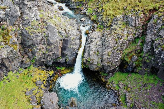
 Duration
 Highlights
 Type
Type